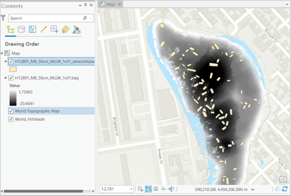
You can use this model in the Detect Objects Using Deep Learning available in the Image Analyst toolbox in ArcGIS Pro. The complete workflow involves postprocessing steps using additional tools.
A simplified workflow is also available with a custom tool packaged as an ArcGIS Pro project template. The sections below describe the steps to use the model with this tool.
- Download the Detect Shipwrecks ArcGIS Pro project template to use the Shipwreck Detection pretrained model, or a fine-tuned model as needed.
- Start ArcGIS Pro, and from the project selection screen, click
Select another project template.

- Browse to the downloaded template and click OK.
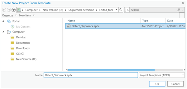
- Provide a name for the new project and click OK.

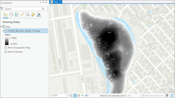
- Ensure that you have added a BAG file in ArcGIS Pro.
You can download a sample BAG file for Jamaica Bay from the NOAA portal.
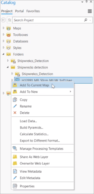
- Zoom to an area of interest.
- Browse to <Project_name>.tbx under Toolboxes in the Catalog pane to access the
Shipwreck Detection from Bathymetric data tool.
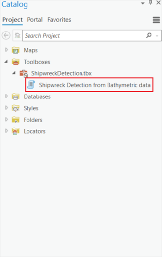
- On the Parameters tab, set the variables as follows:
- Input Raster—Select the BAG file layer.
- Output Detected Shipwrecks—Set the output feature class that will contain the detected shipwrecks.
- Model Definition (optional)—Select the Ship Detection (SAR) pre-trained model .dlpk file.
- Model Arguments (optional)—Change the values of the arguments if required.
- Non Maximum Suppression—Optionally, check the check box to remove the overlapping features with lower confidence.
If checked, do the following:
- Set Confidence Score Field.
- Set Class Value Field (optional).
- Set Maximum Overlap Ratio (optional).
- Processor Type—Select CPU or GPU as needed.
If GPU is available, it is recommended that you select GPU and set GPU ID to the GPU to be used.
- Cell Size—Change if required.
The expected BAG file resolution is 0.5 meters.
Note:
If the model definition is not passed, the model will be automatically downloaded from ArcGIS Living Atlas of the World.
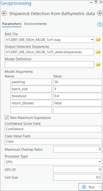
- Click Run.
The output layer is added to the map.
