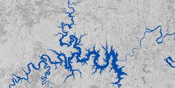
This document explains how to use the Water Body Extraction (SAR)—USA pretrained model available on ArcGIS Living Atlas of the World. The model is used to extract water bodies from Sentinel-1 SAR imagery.
Water is an indispensable resource not only for humans but for all living being on earth. Conservation and management of water resources helps sustain and thrive life and also prevent its destruction. Water management can include activities such as monitoring the changing course of rivers and streams, regional planning, flood management, agriculture, and so on, all of which requires survey and planning, including accurate mapping of water bodies. Hence, extraction of water bodies from remote sensing data is critical to record how this dynamic changes and map their current forms. The remote sensing data used here is SAR, which is a powerful imagery for information extraction, as it is unaffected by cloud cover, acquires images overnight, enables all-weather imaging, and it is cost effective compared to other imageries. This deep learning model can be used to automate the task of extracting water bodies from SAR imagery.
Model details
This model has the following characteristics:
- Input—Sentinel-1 C band SAR VH polarization band raster.
- Output— Binary raster representing water and nonwater classes.
- Compute—This workflow is compute intensive and a GPU with compute capability of 6.0 or higher is recommended.
- Applicable geographies—This model is expected to work well on Sentinel-1C band VH band raster for the United States
- Architecture—This model uses the DeepLab model architecture implemented in ArcGIS API for Python.
- Accuracy metrics—This model has a precision of 0.945, recall of 0.92, and F1-score of 0.933.
Access and download the model
Download the Water Body Extraction (SAR)—USA pretrained model from ArcGIS Living Atlas of the World. Alternatively, access the model directly from ArcGIS Pro, or consume it in ArcGIS Online using Professional or Professional Plus user type.
- Browse to ArcGIS Living Atlas of the World.
- Sign in with your ArcGIS Online credentials.
- Search for Water Body Extraction (SAR)—USA and open the item page from the search results.
- Click the Download button to download the model.
You can use the downloaded .dlpk file directly in ArcGIS Pro, or upload and use it in ArcGIS Enterprise. Additionally, you can fine-tune the pretrained model if necessary.
Release notes
The following are the release notes:
| Date | Description |
|---|---|
| September 2022 |
|