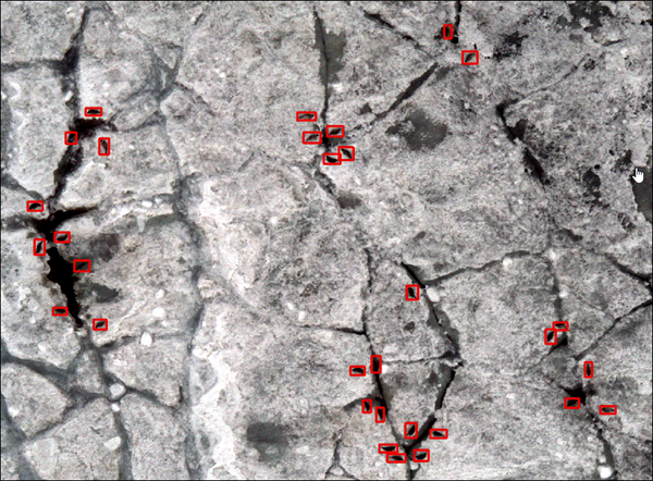
Monitoring the count of any animal is important for understanding its habitat and helps in its conservation. The count can give insights about the animal's habitat, breeding site, migration pattern, and other behaviors. Seals form an important part of the food chain in the cryosphere region of the Arctic. The effects of global warming and climate change can impact sea ice and, thus, the seals. Vulnerable animals such as polar bears feed on these seals. Reduction in the seal population can heavily impact the ecosystem.
Developments in drone imagery and associated technology have led to advancements in detection and identification of different types of wildlife. Arctic Seals live in extreme climatic conditions that are uninhabitable to humans. Drones can work in these extreme conditions and cover vast areas in less time. Deep learning models applied on drone imagery can be effective in detecting animals and can help in census counts. This model detects ringed seals and brown bearded seals in high-resolution drone imagery of the Arctic region.
Model details
This model has the following characteristics:
- Input—High-resolution (3–5 centimeter) individual drone images or an orthomosaic.
- Output—Feature class containing detected seals.
- Compute—This workflow is compute intensive, and a GPU with minimum CUDA compute capability of 6.0 is recommended.
- Applicable geographies—The model is expected to work well in the cryosphere region of the Arctic.
- Architecture—This model uses the FasterRCNN model architecture implemented in ArcGIS API for Python.
- Accuracy metrics—This model has an average precision score of 0.776 for seals with an F-1 score of 0.874.
Access and download the model
Download the Arctic Seal Detection pretrained model from ArcGIS Living Atlas of the World. Alternatively, access the model directly from ArcGIS Pro using the Detect Objects Using Deep Learning tool, or consume it in ArcGIS Online using Professional or Professional Plus user type.
- Browse to ArcGIS Living Atlas of the World.
- Sign in with your ArcGIS Online credentials.
- Search for Arctic Seal Detection and open the item page from the search results.
- Click the Download button to download the model.
You can use the downloaded .dlpk file directly in ArcGIS Pro, or upload and use it in ArcGIS Enterprise. Additionally, you can fine-tune the pretrained model if necessary.
Release notes
The following are the release notes:
| Date | Description |
|---|---|
| March 2022 | First release of Arctic Seal Detection |