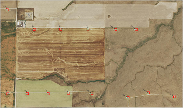
There is a rapid increase in the number of installations of wind turbines across the globe. These installations are visible in aerial imagery. However, if done manually, it is a tedious task to analyze imagery and mark these installations on a map. This model can detect wind turbines and can draw bounding boxes around their exact locations.
Model details
This model has the following characteristics:
- Input—8-bit, 3-band high-resolution aerial imagery (60 cm).
- Output—Feature class containing detected wind turbines.
- Compute—This workflow is compute intensive and a GPU with compute capability of 6.0 or higher is recommended.
- Applicable geographies—This model is designed to work well across the United States and Netherlands but can also be tried in other areas.
- Architecture—This model uses the FasterRCNN model architecture implemented in ArcGIS API for Python.
- Accuracy metrics—This model has an average precision score of 0.96.
Access and download the model
Download the Wind Turbine Detection pretrained model from ArcGIS Living Atlas of the World. Alternatively, access the model directly from ArcGIS Pro using the Detect Objects Using Deep Learning tool, or consume it in ArcGIS Online using Professional or Professional Plus user type.
- Browse to ArcGIS Living Atlas of the World.
- Sign in with your ArcGIS Online credentials.
- Search for Wind Turbine Detection and open the item page from the search results.
- Click the Download button to download the model.
You can use the downloaded .dlpk file directly in ArcGIS Pro, or upload and use it in ArcGIS Enterprise. Additionally, you can fine-tune the pretrained model if necessary.
Release notes
The following are the release notes:
| Date | Description |
|---|---|
| March 2022 |
|