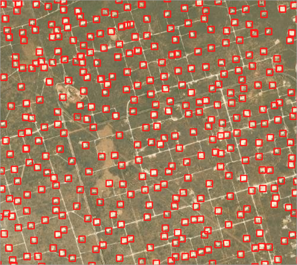
The oil and gas industry in the United States has witnessed significant growth in the last decade. Development in technology and the extraction process has given access to reserves that were earlier out of reach. This has led to increased production in many regions and most remarkably in the Permian Basin. With increasing production, the number of well pads is also increasing. Well pads are relatively flat areas that are cleared for drilling and extraction of oil and natural gas.
This deep learning model can automate the detection of well pads and can be used to monitor the progress of new drilling. It can provide competitive intelligence as well as potentially help identify illegal drilling. Additionally, knowing where the new well pads are coming up can enable better planning and resource allocation.
Model details
This model has the following characteristics:
- Input—Sentinel-2 L2A BOA Reflectance product in the form of a raster, mosaic dataset, or image service. .
- Output—Feature class containing bounding boxes depicting well pad locations.
- Compute—This workflow is compute intensive and a GPU with compute capability of 6.0 or higher is recommended.
- Applicable geographies—This model is designed to work well in the Permian Basin (west Texas and southeastern New Mexico) in the United States.
- Architecture—This model uses the FasterRCNN model architecture implemented in ArcGIS API for Python.
- Accuracy metrics—This model has an average precision score of 0.924.
Access and download the model
Download the Well Pad Detection - Permian Basin pretrained model from ArcGIS Living Atlas of the World. Alternatively, access the model directly from ArcGIS Pro, or consume it in ArcGIS Online using Professional or Professional Plus user type.
- Browse to ArcGIS Living Atlas of the World.
- Sign in with your ArcGIS Online credentials.
- Search for Well Pad Detection—Permian Basin and open the item page from the search results.
- Click the Download button to download the model.
You can use the downloaded .dlpk file directly in ArcGIS Pro, or upload and use it in ArcGIS Enterprise. Additionally, you can fine-tune the pretrained model if necessary.
Release notes
The following are the release notes:
| Date | Description |
|---|---|
| November 2021 |
|