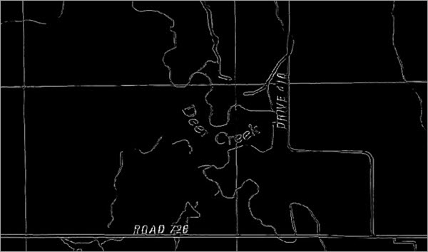
This document explains how to use the Edge Detection deep learning model available on ArcGIS Living Atlas of the World.
Edge detection is a method for simplifying image analysis by reducing data complexity while retaining crucial structural details. It is a useful tool for both digitization of scanned maps and remote sensing workflows, where it enables the efficient extraction and analysis of critical geographical features.
In digitization workflows for scanned maps, edge detection plays a crucial role in enhancing the clarity of text and graphics, facilitating the extraction of features for further analysis. By isolating edges, it becomes easier to interpret shapes, detect objects, and perform downstream tasks within the workflow.
In remote sensing workflows, edge detection assists in tasks such as parcel extraction, farm boundary detection, and the extraction of linear features such as roads and river streams. Thus, it is useful in applications such as agriculture, where precisely identifying farm boundaries is crucial for land management and resource allocation.
This model simplifies the representation of an image by identifying sharp changes in pixel intensity, and effectively delineating boundaries and contours. It generates a probability raster, in which each pixel represents the probability of it being a part of an edge in the image.
License requirements
To complete this workflow, the following are the license requirements:
- ArcGIS Desktop—ArcGIS Image Analyst extension for ArcGIS Pro
- ArcGIS Enterprise—ArcGIS Image Server
- ArcGIS Online—ArcGIS Pro or Professional Plus user type
Model details
This model has the following characteristics:
- Input—Raster with red, green, and blue bands.
- Output—A single-band probability raster of potential edges.
- Compute—This workflow is compute intensive, and a GPU with minimum CUDA compute capability of 6.0 and 8 GB of dedicated VRAM or higher is recommended.
- Applicable geographies—The model is expected to work globally.
- Architecture—This model uses the DiffusionEdge model architecture.
Access and download the model
Download the Edge Detection pretrained model from ArcGIS Living Atlas of the World. Alternatively, access the model directly from ArcGIS Pro, or consume it in ArcGIS Image for ArcGIS Online.
- Browse to ArcGIS Living Atlas of the World.
- Sign in with your ArcGIS Online credentials.
- Search for Edge Detection and open the item page from the search results.
- Click the Download button to download the model.
You can use the downloaded .dlpk file directly in ArcGIS Pro, or upload and use it in ArcGIS Enterprise.
Release notes
The following are the release notes:
| Date | Description |
|---|---|
| December 2024 | First release of Edge Detection |