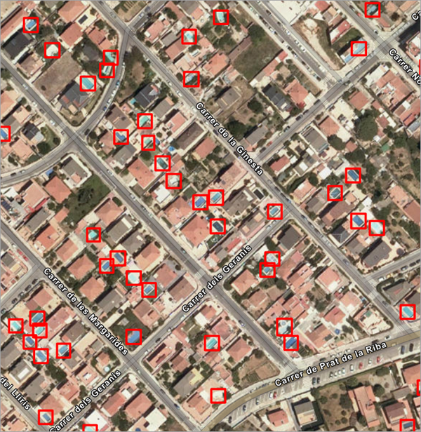
Swimming pools are important for property tax assessment because they impact the value of the property. Tax assessors at local government agencies often rely on expensive and infrequent surveys, leading to assessment inaccuracies. Finding pools that are not on the assessment roll (such as those recently constructed) is valuable to assessors and will ultimately result in additional revenue for the community.
This deep learning model helps automate the task of finding pools from high-resolution satellite imagery. This model can also benefit swimming pool maintenance companies and help redirect their marketing efforts. Public health and mosquito control agencies can also use this model to detect pools and drive field activity and mitigation efforts.
License requirements
To complete this workflow, the following are the license requirements:
- ArcGIS Desktop—ArcGIS Image Analyst extension for ArcGIS Pro
- ArcGIS Enterprise—ArcGIS Image Server
- ArcGIS Online—Professional or Professional Plus user type.
Model details
This model has the following characteristics:
- Input—Raster, mosaic dataset, or image service (5–30 centimeter spatial resolution).
- Output—Feature class containing bounding boxes depicting pool locations.
- Compute—This workflow is compute intensive and a GPU with compute capability of 6.0 or higher is recommended.
- Applicable geographies—This model is designed to work well in the United States.
- Architecture—This model uses the FasterRCNN model architecture implemented in ArcGIS API for Python.
- Accuracy metrics—This model has an average precision score of 0.59.
Access and download the model
Download the Pool Detection—USA pretrained model from ArcGIS Living Atlas of the World. Alternatively, access the model directly from ArcGIS Pro, or consume it in ArcGIS Online usingProfessional or Professional Plus user type.
- Browse to ArcGIS Living Atlas of the World.
- Sign in with your ArcGIS Online credentials.
- Search for Pool Detection—USA and open the item page from the search results.
- Click the Download button to download the model.
You can use the downloaded .dlpk file directly in ArcGIS Pro, or upload and use it in ArcGIS Enterprise. Additionally, you can fine-tune the pretrained model if necessary.
Release notes
The following are the release notes:
| Date | Description |
|---|---|
| July 2021 |
|