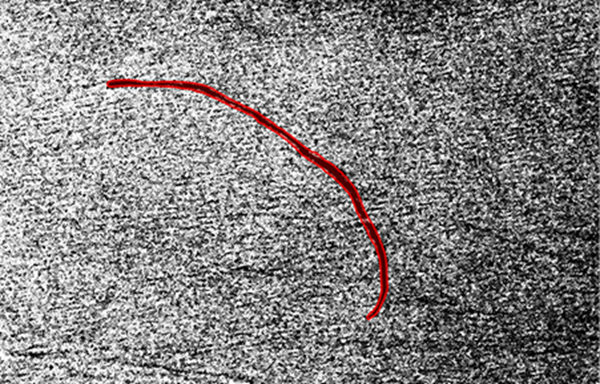
The Oil Spill Detection (SAR) pretrained model available on ArcGIS Living Atlas of the World is used to extract oil spills from Sentinel-1 Synthetic Aperture Radar (SAR) imagery.
Oil spills are a major source of marine pollution and affect the environment, economy, and marine ecosystems. Toxic chemicals from oil spills can remain in the ocean for years and can sink down to the seabed, affecting sedimentation rates. While many oil spills are accidental, some are caused deliberately by cargo ships dumping waste oil and bilgewater. It is difficult to identify, detect, and remove oil from the ocean surface, and routine monitoring can help prevent illegal dumping and aid with remediation efforts.
This deep learning model automates the task of detecting potential oil spills from Sentinel-1 SAR data. In addition to being inexpensive, SAR data is collected day and night in all weather conditions without being affected by cloud cover. Use this model to identify potential oil spills that need to be reviewed or monitored, significantly reducing time and effort.
Model details
This model has the following characteristics:
- Input—8-bit, three-band Sentinel-1 C band SAR GRD VV polarization band raster.
- Output—Feature layer representing oil spills.
- Compute—This workflow is compute intensive and a GPU with compute capability of 6.0 or higher is recommended.
- Applicable geographies—This model is expected to work well with Sentinel-1 VV band raster globally.
- Architecture—This model uses the MaskRCNN model architecture implemented in ArcGIS API for Python.
- Accuracy metrics—This model has a precision score of 69 percent.
Access and download the model
Download the Oil Spill Detection (SAR) pretrained model from ArcGIS Living Atlas of the World. Alternatively, access the model directly from ArcGIS Pro, or consume it in ArcGIS Online usingProfessional or Professional Plus user type.
- Browse to ArcGIS Living Atlas of the World.
- Sign in with your ArcGIS Online credentials.
- Search for Oil Spill Detection (SAR) and open the item page from the search results.
- Click the Download button to download the model.
You can use the downloaded .dlpk file directly in ArcGIS Pro, or upload and use it in ArcGIS Enterprise. Additionally, you can fine-tune the pretrained model if necessary.
Release notes
The following are the release notes:
| Date | Description |
|---|---|
| November 2022 |
|