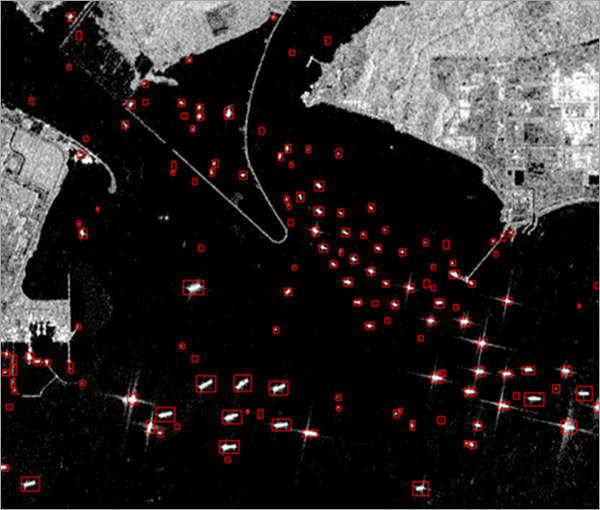
Ship detection plays an important role in port management, maritime rescue, cargo transportation, and national defense. Satellite imagery provides data with high spatial and temporal resolution, which is useful for ship detection. SAR data has advantages over optical data, as microwaves are capable of penetrating clouds and can be used in all types of weather. SAR data is also useful for locating ships during storms in rescue missions.
This model was trained using the Large-Scale SAR Ship Detection Dataset-v1.0 (LS-SSDD-v1.0), prepared from Sentinel-1 imagery.
Model details
This model has the following characteristics:
- Input—Sentinel-1 C band SAR VV polarization band raster.
- Output—Feature class containing detected ships as polygons.
- Compute—This workflow is compute intensive and a GPU with compute capability of 6.0 or higher is recommended.
- Applicable geographies—This model is designed to work well on Sentinel-1 VV band raster imagery for any geography.
- Architecture—This model uses the Faster R-CNN model architecture implemented in ArcGIS API for Python.
- Accuracy metrics—This model has an average precision score of 0.70.
Access and download the model
Download the Ship Detection (SAR) pre-trained model from ArcGIS Living Atlas of the World. Alternatively, access the model directly from ArcGIS Pro using the Detect Ships from SAR ArcGIS Pro project template, or consume it in ArcGIS Online using Professional or Professional Plus user type.
- Browse to ArcGIS Living Atlas of the World.
- Sign in with your ArcGIS Online credentials.
- Search for Ship Detection (SAR) and open the item page from the search results.
- Click the Download button to download the model.
You can use the downloaded .dlpk file directly in ArcGIS Pro, or upload and use it in ArcGIS Enterprise. Additionally, you can fine-tune the pretrained model if necessary.
Release notes
The following are the release notes:
| Date | Description |
|---|---|
| July 2021 |
|