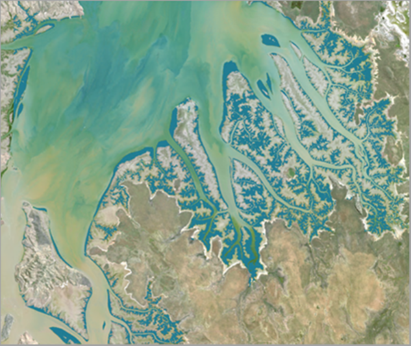
Mangroves are critical to the maintenance and conservation of healthy coastal ecosystems. They are rich in biodiversity and are home to a diverse set of plant and animal species. Mangroves protect inland coastal areas from erosion and storm surge impacts such as from tsunamis. These factors make mangrove monitoring and conservation an important activity. Due to various climatic phenomena and coastal activity such as reclamation for development, mangrove forests are rapidly shrinking. This warrants active monitoring and conservation efforts of mangroves. This deep learning model enables rapid monitoring of mangrove forests.
There are a few public datasets depicting location of mangroves on a map, but the spatial and temporal coverage of these public datasets might not always satisfy the user's requirements. It is also difficult to create datasets for a specific time, as it requires expertise and time. Use this deep learning model to automate the tedious manual process and reduce the required time and effort, significantly.
Model details
This model has the following characteristics:
- Input—Raster, mosaic dataset, or image service.
- Output— A classified raster with two classes: mangrove and other.
- Compute—This workflow is compute intensive and a GPU with compute capability of 6.0 or higher is recommended.
- Applicable geographies—This model is expected to work well globally.
- Architecture—This model uses the U-net model architecture implemented in ArcGIS API for Python.
- Accuracy metrics—This model has an accuracy of 97.4 percent.
Access and download the model
Download the Mangrove Classification (Landsat 8) pretrained model from ArcGIS Living Atlas of the World. Alternatively, access the model directly from ArcGIS Pro, or consume it in ArcGIS Online usingProfessional or Professional Plus user type.
- Browse to ArcGIS Living Atlas of the World.
- Sign in with your ArcGIS Online credentials.
- Search for Mangrove Classification (Landsat 8) and open the item page from the search results.
- Click the Download button to download the model.You can use the downloaded .dlpk file directly in ArcGIS Pro, or upload and use it in ArcGIS Enterprise. Additionally, you can fine-tune the pretrained model if necessary.
Release notes
The following are the release notes:
| Date | Description |
|---|---|
| November 2021 |
|