Shapefile is a legacy format of Esri to describe geo-referenced GIS features (points, lines, polygons and limited multipatches). It has limited support for GIS attributes and should be considered superseded by Esri FileGDB.
Import settings
The shapefile import has the following options:
File |
Note:
|
Coordinate System |
|
Using Attributes from SHP file |
Note:The Source field is set to Object, which denotes that the CGA height attribute is controlled by the object attribute of the lot. |
Graph settings
Run Generate Bridges Tool after Import | If enabled, the Generate Bridges Tool is executed on a following wizard page. |
Run Simplify Graph Tool after Import | If enabled, the Simplify Graph Tool is executed on a following wizard page. |
Run Graph Cleanup Tool after Import | Depending on the shapefile data it may be necessary to cleanup the graph segments after import. If enabled, the graph cleanup tool is executed on a following wizard page. |
Create Street/Intersection Shapes from Graph | If enabled, the shape creation parameter of the graph nodes and segments will be enabled and street shapes are created. |
Create Block/Lot Shapes from Graph | If enabled, the shape creation parameter of potentially created street blocks will be enabled and shapes are created. |
Map shapefile attributes
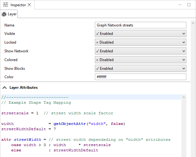
If enabled, an imported graph layer will contain the following layer attribute code:

This mapping controls the width of the street shapes generated from the graph center lines. In the default behaviour, the object attribute width is used to determine the resulting street width, and defaults to 8 if no object attribute is found.
Advanced users can edit the default mapping code by changing the cga code in the file shp.ceattr, located in /ce.lib/rules/.