Get map data from ArcGIS Online and ArcGIS Enterprise to quickly and easily add context, such as streets, parcels, terrain and basemaps to an existing CityEngine scene. You can also type in a location and create a new CityEngine scene from scratch without needing any data.
- Start CityEngine.
- Sign in to your organization Portal.
- Click File > Get map data... .
The Get map data dialog opens.
- Pan with the left mouse button to navigate around the map.
You can also search for an area and then zoom in or out to the area you want.
- Click Select Basemap to choose the basemap type drop-down menu.
- Click Set extent.
This specifies a rectangle of the area of the map to download into the scene. You can also manually enter the width and height and the coordinates of the area to download.
Note:
If you have an existing CityEngine scene, and select an extent that is further away than 500 kilometers from the existing scene data, CityEngine displays an error and you will need change the location of the extent.
- Select the basemap resolution.
- Click Get Terrain if you would like to include elevation data with your map.
Note:
To get elevation data with your map you need to have an Organizational ArcGIS Online account.
- Add Open Street Map (OSM) data to your scene.
OSM data contains a map of the world created by users and free to use under an open license. Select Download networks for street data and Download polygons for polygonal shapes such as building footprints.
Note:
You may experience long download times if you select an area that is too large. This happens often when you are zoomed out too far and have a small map scale.
- Click OK.
If applicable the OSM dialog opens where you can optionally customize your OSM import.
- Click Finish.
The map with terrain, streets, and polygons aligned to the elevation data is added to your CityEngine scene.
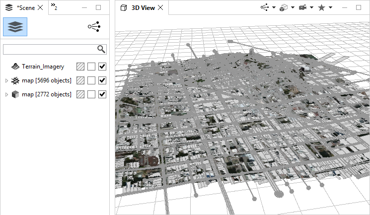
Note:
Get map data will automatically convert data to the current CityEngine coordinate system without any restrictions.
Create a 3D city
To add more detail to your scene, quickly create 3D building models and streets with built-in CityEngine rules.
Tip:
Select all objects and click the Align Terrain to shapes tool  to align the terrain to building footprints and streets and makes the shapes more visible. This will give better 3D visualizations.
- Select all shapes and objects in your scene.
- Click
 .
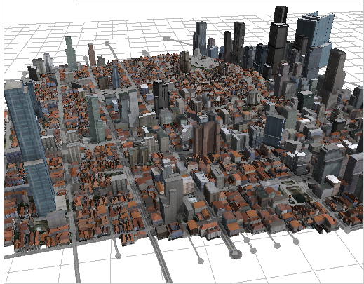
.For more realistic buildings as in the image below, select an appropriate style for the building footprints in the Inspector.