3D layers are cached web layers that are optimized for visualizing and working with large amounts of 3D content. You can publish a hosted 3D layer from a scene layer package (SLPK) or a 3D tiles package (.3tz).
You can view most 3D layers in Scene Viewer, ArcGIS Pro, or ArcGIS Earth.
3D layer types
To visualize and work with 3D data, you must define the layer type that best represents the data. ArcGIS provides multiple 3D layer types, allowing you to comprehensively capture different aspects of the natural and man-made environments.
The following table summarizes the types of 3D layers you can create and provides links to more information about, and examples of, each layer type:
| 3D layer type | Supports associated feature layer (editable) | Supports SLPK (read only) | Supports 3tz (read only) |
|---|---|---|---|
Yes | Yes | Yes | |
Yes | Yes | No | |
Yes | Yes | No | |
No | No | Yes | |
No | Yes | Yes | |
No | Yes | No | |
No | Yes | No |
3D object
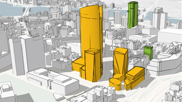
You can use 3D object layers to represent and visualize 3D objects, such as textured or untextured buildings that are modeled in 3D. From ArcGIS Pro, you can create a 3D object scene layer from multipatch data published directly to ArcGIS Online either as a web scene layer with an associated feature layer or from an SLPK. In ArcGIS Online, you can publish a 3D object scene layer from either a hosted feature layer or from an SLPK. Alternatively, you can create an empty 3D object scene layer and edit the layer in Scene Viewer to add content.
In addition, ArcGIS CityEngine 2016.0 and later can export an SLPK from which you can publish a 3D object scene layer.
3D point
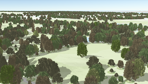
To ensure fast visualization in all clients, cached point scene layers are used to display large amounts of point data not possible with a point feature layer. Point scene layers are automatically thinned to improve performance and visibility at smaller scales. Automatic thinning means that not all features are displayed at small scales; as you zoom in, additional features are displayed. For example, you can use a point scene layer to display all the trees in a city. In ArcGIS Pro, you can create a point scene layer from a feature layer shared directly to ArcGIS Online as a web scene layer. Also, in ArcGIS Online, you can publish a point scene layer from a hosted feature layer.
Building
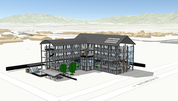
Building layers allow you to visualize complex digital models of buildings and interact with all the components of the building. With building layers, you can explore a building's composition, properties, and location of structures in a building digital model. Building layers allow you to query and isolate discipline layers—such as structural or architectural—or categories, such as walls or roofs. They are used for engineering, architecture, surveying, and construction purposes. See Maintain and work with a building scene layer in the ArcGIS Pro help for an explanation of the multiple ways you can implement, use, and manage building layers. You can publish a building layer from ArcGIS Pro 2.3 or later as an SLPK. Beginning with ArcGIS Pro 2.7, you can also publish a building layer with an associated hosted feature layer to ArcGIS Online.
Gaussian splat layers
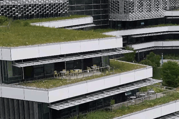
The Gaussian splat layer provides highly realistic visualization of complex geometry. For example, you can represent thin and complex structures as well has have organic shapes like vegetation. Gaussian splat layers are best suited for inspection workflows, such inspections of bridges, telecom towers, or other infrastructure.
Because the Gaussian splat layer type allows you to achieve the highest digital visual appearance, you can capture important structures as a Gaussian splat layer and combine it in your scene with additional data such as 3D basemaps or feature layers.
Mesh
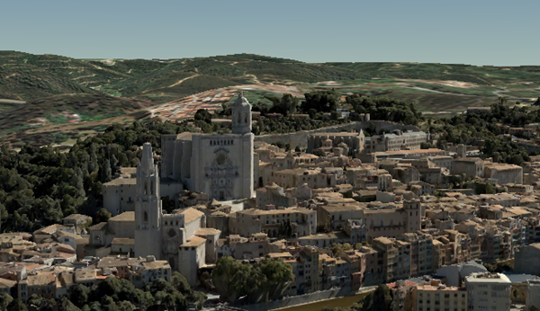
Mesh data is typically captured by an automated process for constructing realistic objects from large sets of overlapping imagery. The result integrates the original input image information as a textured mesh using a triangular interlaced structure. A mesh includes elevation information and can represent built and natural 3D features, such as building walls, trees, valleys, and cliffs, with realistic textures. Mesh layers are generally created for citywide 3D mapping and can be created using ArcGIS Drone2Map and ArcGIS Pro 2.2 or later, which can then be shared to ArcGIS Online as an SLPK. See Integrated mesh scene layer in the ArcGIS Pro help for more information on this type of layer.
Point cloud
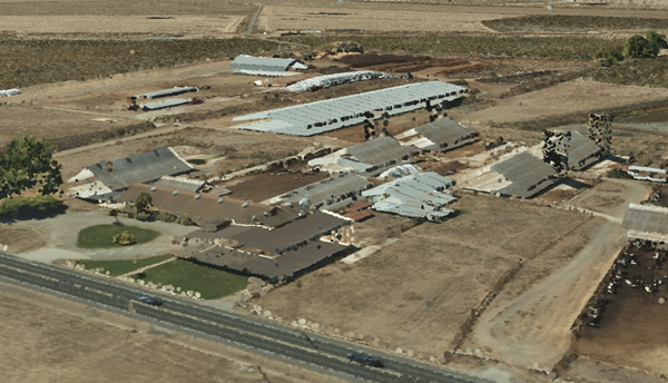
Point cloud layers allow fast consumption and display of large volumes of point cloud data in Scene Viewer and ArcGIS Pro. You can configure these layers in ArcGIS Pro and create an SLPK to publish it in a portal.
Point cloud layers in Scene Viewer can appear differently based on the symbology renderer type configured from ArcGIS Pro. Scene Viewer supports the following renderer types in ArcGIS Pro:
- Stretch
- Classify
- Unique Values
- RGB
Voxel
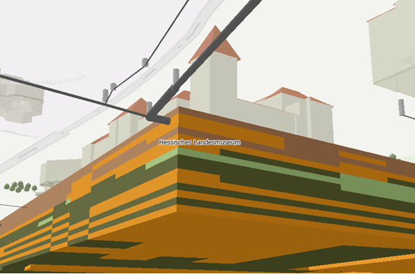
A voxel layer represents multidimensional volumetric 3D or 4D data in Scene Viewer and ArcGIS Pro. In local scenes, you can visualize atmospheric or oceanic data, geological underground models, or space-time cubes as voxel scene layers. Use voxel layers to access and explore volumetric data about the world and better understand conditions that you can't physically experience. For example, an underground model visualized as a voxel layer can be viewed together with buildings or subterranean utilities to evaluate the underground for planned construction or maintenance.
You can create a voxel layer in ArcGIS Pro and share it as a web layer or within a local scene.
Note:
- For optimal performance of voxel layers, a high-performance graphic card is required. For more information, see Scene Viewer requirements.
- Mobile support differs across devices. Voxel layers may not display as expected.
- The Elevation Profile interactive tool is not available with voxel layers.
- The measurement distance and area honor the vertical exaggeration applied. The results may vary depending on whether a vertical exaggeration is set.
Scene and 3D tiles services
Besides the 3D layer types described above, you can also distinguish 3D layers by the service that populates the item.
Tip:
The source service type is listed on the Overview tab of the layer's item page.
Scene services use the Indexed 3D Scene Layer (I3S) format for efficient streaming. You can package the 3D data as an SLPK, or publish directly from a feature layer. You can represent 3D object, building, mesh, 3D point, point cloud, and voxel data using I3S.
Editing is supported for 3D object and 3D point layers that are powered by a source scene service and that have an associated a feature layer. These also allow for full or partial update of the cached 3D data.
3D tiles services use 3D tiles datasets or 3D tiles packages (.3tz) to store cached 3D data. A tileset defines three-dimensional data that meets the Open Geospatial Consortium (OGC) 3D tiles specification. You can represent 3D object, mesh, or Gaussian splat layer types. 3D tiles services cannot not be edited or used for geoprocessing.
Because the source service differs, the privilege required to publish differs. To publish a 3D layer that is powered by a scene service, you must be a member of a role that has the privilege to publish hosted scene layers in addition to the privilege to create, update, and delete content. To publish a 3D layer that is powered by a 3D tiles service, member of a role that has the privilege to publish hosted tile layers in addition to the privilege to create, update, and delete content.
Note:
At this release, the layer item names still include the words scene and 3D tiles. This is to help gradually move you from the old item names to the new consolidated name.


