3D buildings are an essential layer when authoring a scene. They provide a realistic and immersive representation of the urban environment and are used for a variety of purposes, including urban planning, environmental analysis, and emergency management.
Within ArcGIS, there are several visualization techniques available to create a layer that represents buildings. You can model buildings as individual objects, or you can use an integrated mesh or a point cloud to represent the built environment. Which one you choose will depend on the intended use and the available input data.
Workflows
Buildings as objects
Modeling buildings as separate objects or features is useful when you want to be able to attach information to the buildings individually. This allows you to query, select, filter, and analyze the buildings using the attribute information. ArcGIS supports several workflows to create 3D buildings as objects; depending on the input data, you can create buildings at various levels of detail.
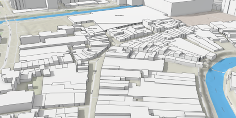
Extrusion
If you have building footprints, you can create LOD1 (Level of detail 1) buildings by extruding the building footprint with a height value. If you don't have height values for your buildings, you can derive this information from other attributes such as the number of floors, or you will need to collect the height information from other data sources such as elevation surfaces or aerial lidar. Esri's 3D buildings solution provides workflows to create elevation source layers from lidar and assign height attribute information to the building footprints. It also has a workflow to generate building footprints from the aerial lidar in case you don't have building footprints. Once you have the height information, you can use this to set the building heights.
Procedural rules
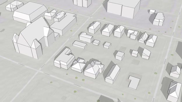
It is possible to create more complex 3D buildings by applying procedural rules to input building footprints. A procedural rule can leverage feature attribute information such as building height, eave height, roof type, and roof direction to generate LOD2 buildings with sloped and ridged roof types and optional generic textures. The 3D buildings solution provides workflows to extract these attributes from the input lidar and includes a rule to create the LOD2 buildings. You can modify this rule or write your own in CityEngine. It is also possible to create your 3D building manually in ArcGIS Pro or CityEngine.
Extract buildings from point clouds
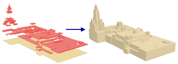
You can extract 3D buildings from lidar using polygons that define the building footprint with the LAS Building Multipatch geoprocessing tool. The benefit of this workflow is that it is simple, captures roof details, and requires only building footprints and lidar as input. The output buildings are less smooth than the buildings generated using a procedural rule.
Import 3D building models
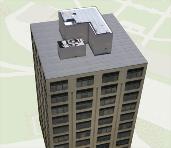
You can create buildings by importing models from 3D modeling software such as CityEngine, Blender, Sketchup, Maya, or AutoDesk 3DS Max. These are typically LOD2 or sometimes LOD3 models with more detailed roofs, facades, and textures. ArcGIS supports the import of various industry-standard formats.
Import BIM data
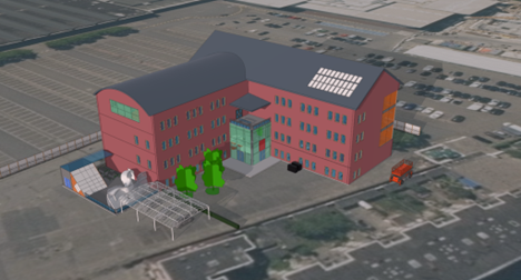
BIM data is typically created using specialized software such as Revit or a host of other BIM software that create IFC data and can include information such as building geometry, materials, equipment data as well as data on energy performance, cost, and maintenance schedules.
When using BIM data to create buildings, all details of the building like the different disciplines and assets are represented as features and can be used to filter for specific assets, and you can use them for space management and asset management.
Other ways to visualize buildings
When buildings are not the focus of a scene and are just needed for context, you can also use an integrated mesh or point cloud to visualize the built environment.
Integrated mesh
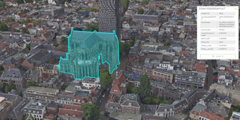
An integrated mesh is a detailed, geospatially accurate 3D model of a project area in which the ground and above-ground feature facades are densely and accurately reconstructed. They are also known as reality meshes or textured meshes. An integrated mesh can be created in ArcGIS through a family of products called ArcGIS Reality. This is a suite of photogrammetry software products designed to enable reality capture workflows for sites, cities, and countries, leveraging drone or aerial imagery. You can drape a 2D building footprints layer over the mesh if you need to access building information individually.
Point cloud
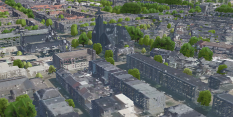
A point cloud is a collection of dense spatial points that are represented as X, Y, and Z coordinates with additional attribute information. Point cloud data can be collected using a variety of methods, including terrestrial lidar, airborne lidar, and photogrammetry. The buildings in the point cloud need to be classified to visualize them as a separate object. The ArcGIS 3D Analyst extension in ArcGIS Pro can be used to classify buildings manually or using rule-based classification techniques. Once the buildings are classified, you can filter the point cloud based on the building class code and share the layer as a scene layer to your organization.
Setting layer properties
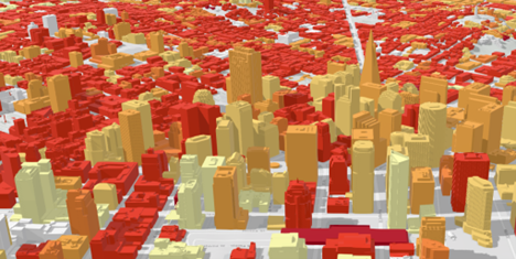
You can modify the layer properties of the building layer such as symbology, transparency, display filters, labels, and pop-ups to enhance the visualization. You can set the layer properties in ArcGIS Pro before you publish the layer or change them afterward in Scene Viewer or in another web app that supports modifying the properties of the layer. With regards to symbology, the shape of the buildings is usually driven by the input data. It can be useful to color the buildings by an attribute to, for example, show buildings by age or energy usage.
If you need to see objects inside of buildings, for example, the location of assets inside rooms, you can make the buildings more transparent.
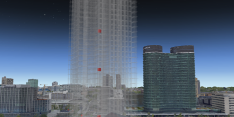
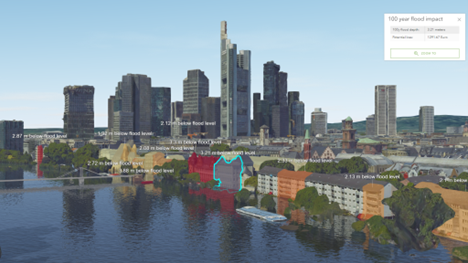
Display filters are useful for showing buildings with a certain attribute or to exclude a set of buildings spatially from the layer. Labels and pop-ups provide information for the buildings visually in the scene or when the user clicks the building.
Considerations
If you want to have your buildings as individual features in a layer, and you need to make frequent changes, consider creating a scene layer with an associated feature layer. The scene layer provides fast display of large amounts of 3D buildings while the associated feature layer allows you to leverage attribute and geometry updates. If your layer does not need to be updated often or you decide to visualize your buildings with an integrated mesh or point cloud, create the scene layer as a scene layer package and add this package as an item in your organization.
Required software
ArcGIS Pro and CityEngine are required to create a layer with 3D buildings as objects. To manage point clouds using LAS datasets, you need ArcGIS Pro standard license with the ArcGIS 3D Analyst extension. You need an ArcGIS Online or Enterprise account to publish and share the layer as a 3D scene service across your organization.
ArcGIS help documentation
Reference material for ArcGIS products:
ArcGIS blogs, stories, and technical papers
The following provide guidance regarding concepts, software functionality, and workflows:
Tutorials
Reference material for lessons:
ArcGIS solutions
Industry-specific configurations for ArcGIS:
- Use the 3D buildings solution to generate buildings.
Esri community
Online 3D community to connect, collaborate, and share experiences:
- Ask the 3D community questions