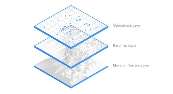
The Ground is an important element in your scene, as it describes the topography of your scene and is often used to place other content on it. A global or local scene contains a predefined elevation surface layer called Ground that cannot be removed. Elevation surface layers are composite layers that contain one or more elevation source layers. The default elevation source layer for this surface is a cached elevation image service in ArcGIS Living Atlas called Terrain3D. If you are not connected to the internet, the Ground elevation will be 0. You can configure the default elevation surface layer as part of your organization's settings in Portal for ArcGIS.

In both ArcGIS Pro and Scene Viewer, you can modify the Ground by adding more elevation source layers. The following datasets can be added as an elevation source layer to the Ground elevation surface layer:
| Supported elevation source | Data location |
|---|---|
Raster dataset | File on disc |
TIN dataset | File on disc |
Web elevation layer | Portal item |
Web imagery layer | Portal item |
Cached elevation image service | ArcGIS Server service |
Web coverage service | ArcGIS Server service |
Workflows
You can configure appearance properties for the ground elevation surface layer or custom surface layer on the Elevation Surface Layer tab. To access this tab in ArcGIS Pro, click Ground or the name of the custom elevation surface layer in the Contents pane and the tab appears in the ribbon. Because Ground represents the surface of the Earth, you can apply navigation rules to it. By default, navigation below ground is disabled. It is often unnecessary to go below ground and can be disorientating when you go there by accident. If your scene contains data that belongs underground, such as subsurface utility pipes or geological features, you can enable below-ground navigation in ArcGIS Pro as well as Scene Viewer.
Caution:
ArcGIS Pro allows you to create custom elevation surface layers that are not currently supported in Scene Viewer.
Considerations
Appearance properties may not be supported in all clients. The following table lists supported clients for each appearance property:
| Appearance property | Supported client |
|---|---|
Ground color | ArcGIS Pro, Scene Viewer |
Vertical exaggeration | ArcGIS Pro |
Navigate underground | ArcGIS Pro, Scene Viewer |
Apply flat shading for tin data | ArcGIS Pro |
Shade relative to light position | ArcGIS Pro |
Exclude from integrated mesh | ArcGIS Pro |
You can share a web scene with these appearance properties set but unsupported properties will be dropped when the web scene is opened in Scene Viewer.
ArcGIS help documentation
Reference material for ArcGIS products: