This is an archive related to a previous version of Esri Maps for MicroStrategy. If you need the current version go to http://doc.arcgis.com/en/maps-for-microstrategy/.
Location types
You can easily add data from MicroStrategy directly to a map.
When adding data from MicroStrategy, select the location type that best represents your information.
Default location types
Esri Maps for MicroStrategy provides the following default location types:
- Address—Depending on the geographic region of your organization, address data can be comprised of any of the following: address, neighborhood, city, subregion, region, state, province, postal code, United States Zip Code, country, and so on. The more address elements your data contains, the more accurate your results will be. The address elements can be in separate fields or they can be contained in one field (single-line address). Both methods of finding addresses are supported, but the best results are obtained by using all address elements and storing them in separate fields.
- Latitude, Longitude—Latitude and Longitude values represent an X, Y coordinate location on the map. You can add X, Y coordinate data if it's in either the World Geodetic Survey 1984 (WGS84) or the Web Mercator coordinate system. If your latitude (Y) values fall between -90 and 90 and the longitude (X) values range from -180 to 180, use WGS84. If your latitude and longitude values are in meters and have 6, 7, or 8 digits before (to the left of) the decimal point, use Web Mercator.
- Standard administrative boundaries—Standard administrative boundaries include cities, states, provinces, United States Zip Codes, postal codes, and countries. The administrative boundaries available to you when adding data are determined by your geographic location. Cities are added to the map as points. States, provinces, postal codes, United States Zip Codes, and countries are added to the map as polygons, which represent both the shape and the location of the place. When entering countries, you can use the Geonames Country Codes as a reference for accepted spelling variations.
Choose a location type
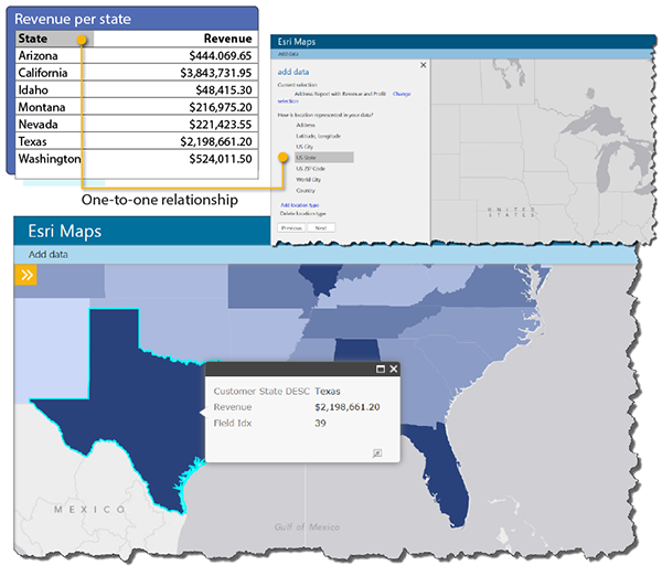
When choosing a location type, it is important to make sure that there is a one-to-one relationship between the rows of data in the dataset and the features in the map layer that is being used to display the data. For example, suppose you want to show revenue by state in a map of the United States. If your dataset has a single row of data for each state, you should use the US States location type.

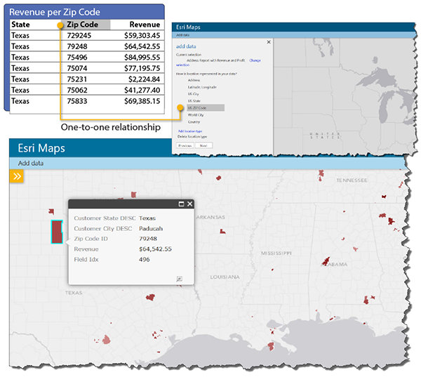
However, if your dataset has multiple rows of data for each state (one row for each Zip Code area, for example) and you use the US States location type, the map may not correctly represent the state revenue values in your data. In this case, you should use a more appropriate location type, such as US ZIP Code, that would have a one-to-one relationship between rows and features.

Specify a location type
If none of the default location types represent your data, you can specify a map service or feature service from ArcGIS to use as a location type. For example, if your organization has its own boundaries (water districts, sales districts, or zoning boundaries), you can map your data using those locations instead of the default location types as long as there is a one-to-one relationship between the rows in your business data and the features in the service. Esri Maps for MicroStrategy supports feature services and map services. For more information on adding a location type based on a map service or feature service, see Add a location type.