Overview
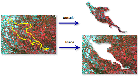
Clips a raster using a rectangular shape according to the extents defined, or will clip a raster to the shape of an input polygon feature class. The shape defining the clip can include the extent of the raster or an area within the raster.
Notes
The default clip extent uses the extent of the map display. You can also clip to the shape of a polygon within the dataset using a feature class. Alternatively, you can specify the x and y minimum and maximum coordinates.
If you choose the Outside clip type, the imagery outside the extents will be removed. If you choose the Inside clip type, the imagery within the extents will be removed.
Parameters
| Parameter | Description |
|---|---|
The input raster layer. | |
Specify whether you want to retain the area inside or outside your clip geometry.
| |
Clipping Geometry / Raster | Specify the extent using a polygon feature, or x and y minimum and maximum coordinates. By default, the extents will be defined by the extent of the map display. |
Use input features for clipping geometry | When selected, the data is clipped according to the geometry of the specified feature class.
|
Output Extent | The x and y coordinates of the current clipping extent. |