Some of the new feature highlights of Drone2Map 2023.1 are described below.
New product types
True Ortho
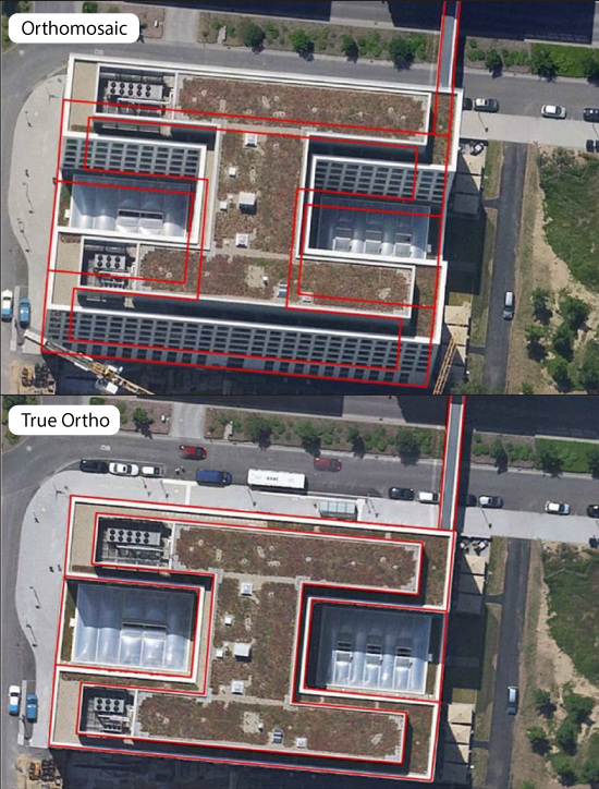
The Orthomosaic product has been renamed to True Ortho for RGB datasets. The True Ortho is available for both Standard and Advanced licenses. It provides a true vertical view of a project area, meaning that it is able to use images from multiple angles and combine them into a seamless orthophoto that only shows objects from a directly nadir point of view regardless of where the object is in the project area. Click here for more information on different types of ortho images.
Hillshade
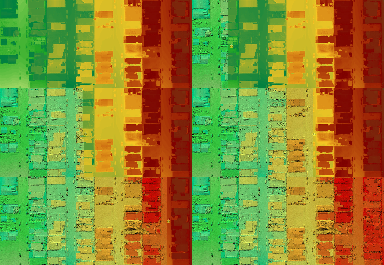
Hillshade versions of the Digital Surface Model and Digital Terrain Model are now available as products and can be shared as hosted layers. These outputs can be very useful for presentation or analysis.
Additional products
Tile packages can now be created from 2D Products so they can be used in other desktop applications or sideloaded onto mobile devices for use in mobile apps.
Two new 3D product output types have been added in 2023.1:
- Single file OBJ product is now created by default, making it easier to use in 3rd Party Apps
- A new 3D Mesh format has been added in the form of the 3D tiles
Improved True Ortho quality
Color balancing
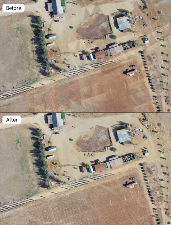
Improvements have been made to color balancing when generating True Ortho products. True Orthos produced in 2023.1 will appear more natural even when individual images may have too high or low of contrast compared to surrounding images.
Artifact removal
Artifacts from moving objects (cars, trains, etc.), reflections, and sub optimal lighting conditions have been adjusted to either reduce or remove problematic areas. This results in a cleaner looking output product without affecting the imagery or elevation surface areas that may be used for analysis.
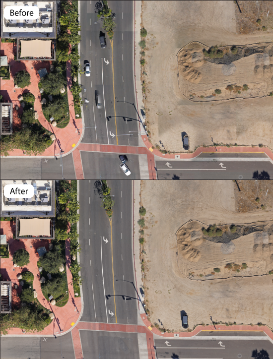
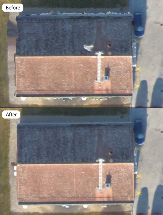
Building edge refinement
The detection and alignment of building edges between images has been improved so buildings have straighter edges and reduced chance of artifacts along edges in 2D and 3D products.
Drone2Map project enhancements
ArcGIS Drone2Map Advanced has increased processing capacity to 300 Gigapixels, resulting in larger areas being mapped in a single project. This is especially useful for cameras that capture large megapixel images.
A default coordinate system can now be defined within the application settings for new projects. This allows the ability to override the default UTM coordinate system in favor of a user specified coordinate system.
Omega, Phi and Kappa values can now be defined when importing a GPS file for your imagery. When using the Inspection template, if your imagery contains Omega, Phi and Kappa values the project image centers will automatically be symbolized based off this orientation information.
The processing report has been improved to show a preview of the ortho product. This preview is available after the Adjust Images step completes. Additionally, the report has been optimized to run less often, reducing overall processing times.
Productivity improvements
The control import process has been streamlined to now consist of a single browser window. Simply browse to the control layer (csv, txt, feature layer) and continue filling out the required information.
A new shortcut has been added to the start menu so the ArcGIS Drone2Map online help can be easily accessed.
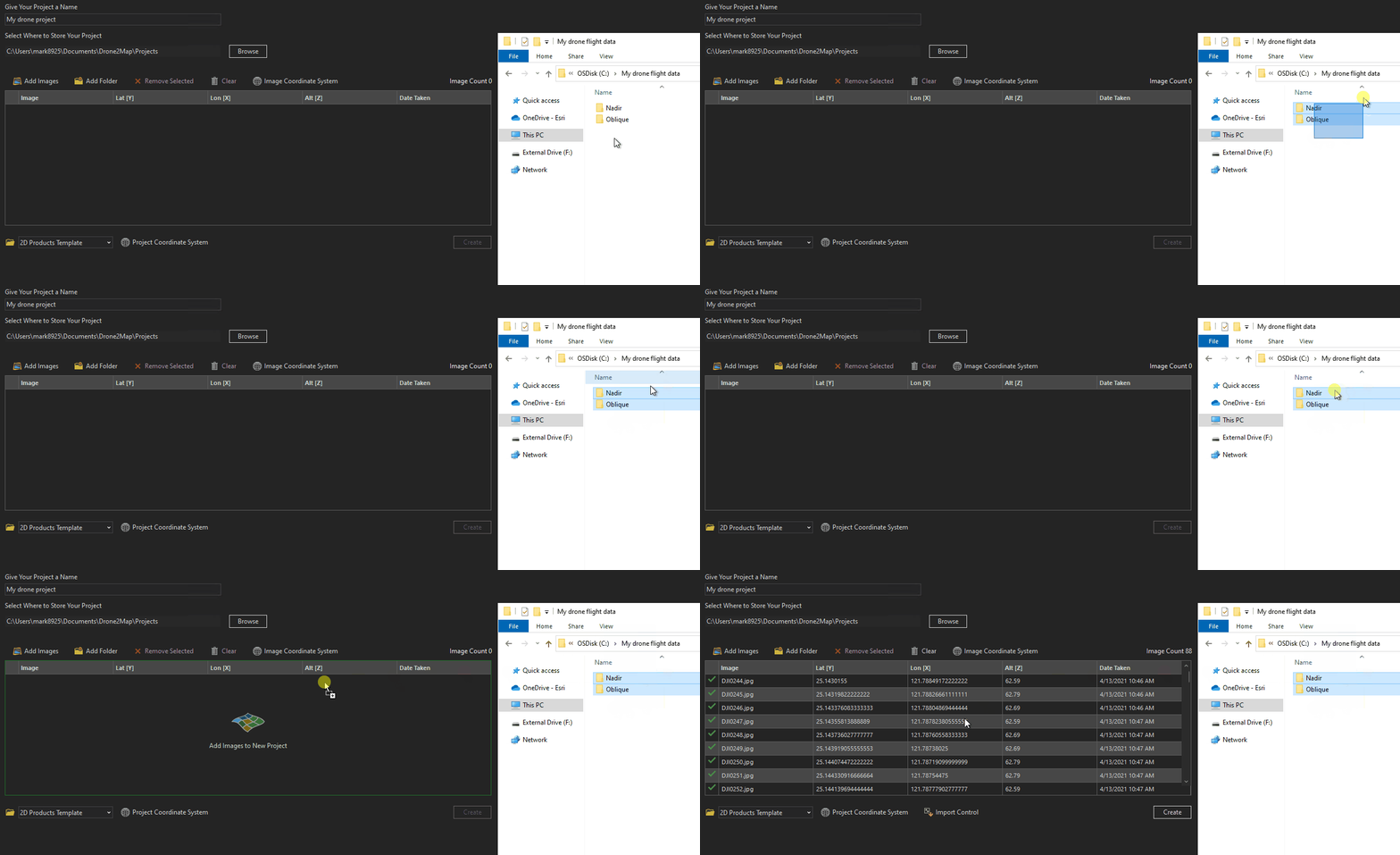
The New Project images table is now interactive. You can drag and drop one or more images or folders onto the table, and they will be added to the project. This is especially useful when your images are split between multiple folders.
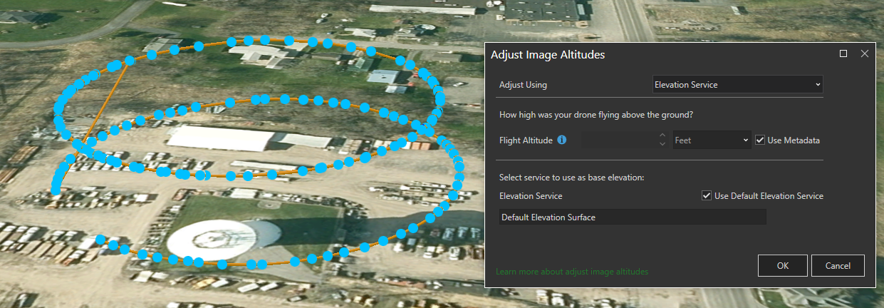
Adjust Image Altitudes tool now allows for images at multiple altitudes to be adjusted at once. Simply select all of the images in your project regardless of altitude and all images will be adjusted and flight paths drawn correctly at different altitudes.
Edit raster enhancements
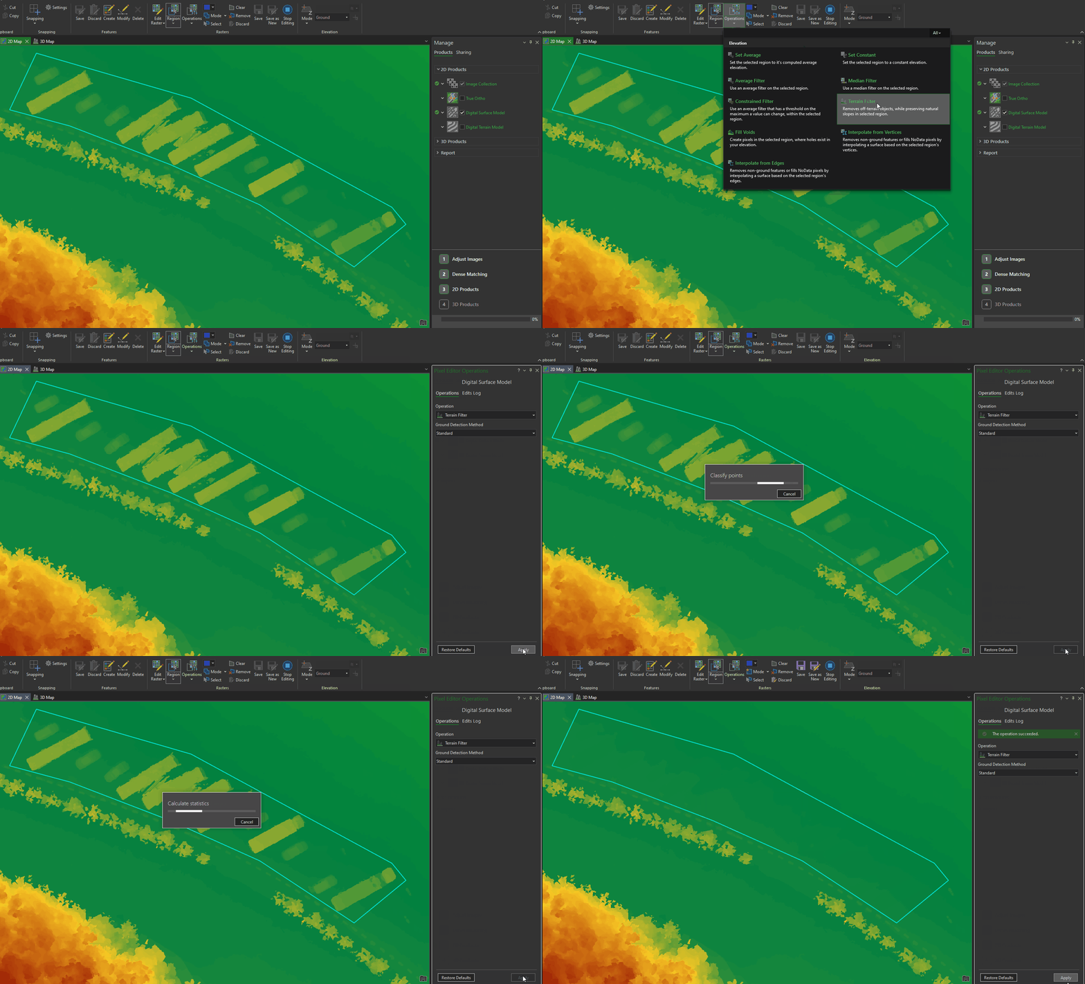
The Orthomosaic editing group has been redesigned and renamed to Rasters. This change allows a better experience for editing True Orthos and Orthomosaics. Additionally Digital Surface Models and Digital Terrain Models are now available to edit using an ArcGIS Drone2Map Advanced License.
Sharing improvements
When sharing products to ArcGIS Online or ArcGIS Enterprise they can now be configured to use the project coordinate system. This is especially useful for organizations that use basemaps in a different coordinate system than Web Mercator.
Once a layer is finished sharing, it will now display the service URL. This can be clicked to open the item directly in ArcGIS Online or ArcGIS Enterprise.
Ground control can now be shared as a hosted feature layer. Additionally, image links can be maintained in the shared layer so that they can be imported back into the project if needed.
Enhanced camera support
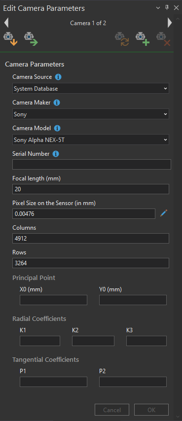
Processing of multiple cameras in the same project is now supported. These cameras may be different camera make and/or model or from the same make and model, but with different serial numbers.
ArcGIS Drone2Map Advanced users will now have the ability to save cameras to a user camera database. This database will store the camera make, model, serial number, and camera parameters. Once saved the camera can be set as the default for future projects where the imagery matches the stored camera.
