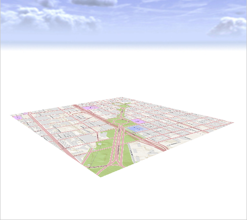
The Texture Layer is a special map layer that adds an image as a flat map to the scene.
Create a Texture Layer
A Texture Layer can be created in the following ways:
- A Texture Layer is imported File > Import > Texture Import in the main menu.
- Click Layer > New Map Layer > Texture in the main menu.
The Texture dialog opens.
Texture Layer options
You can modify the following options when you open the Texture dialog:
Texture File | Choose an image from your workspace. When a georeferenced image is selected, bounds are set automatically. |
Bounds Dimensions | The Width and Height of the resulting texture in meters. When a georeferenced image is selected, this value is set automatically. |
Bounds Location | The location of the resulting texture in meters. When a georeferenced image is selected, this value is set automatically. Note:The button right of Location can be used to change the reference point of the texture's position. |
Texture Layer in CityEngine scene
The new texture is added as a new layer in the Scene Editor. If the texture is not visible in the Viewport, right-click on the Texture Layer and choose Frame Layer.
Note:
All map layers, such as texture layers, aren't available for selection in the Viewport directly. Select texture layers through the Scene Editor.

Inspector options
You can select a texture layer in the Scene Editor to change the following parameters in the Inspector:
Name | Layer name |
Visibility | Layer visibility |
Locked | Lock terrain layer |
Transparency | Layer transparency |
Color | Color value multiplied onto layer |
Wireframe | Wireframe enabled/disabled |
Dimensions | Extent of layer |
Location | Location of layer |
Elevation Offset | Elevation offset applied to layer. This value is also available as a built-in function in the Layer Attributes code. |
Heightmap File | Heightmap file location |
Resolution | The number of terrain mesh vertices in u and V direction. |
Apply Alignments | If enabled, the built-in function "elevationDelta" in the Layer Attributes code returns the elevation deltas resulting from the terrain alignment tool. If disabled, the function returns 0. |
Heightmap Sampling | Bilinear and Nearest Neighbor (hard edges) determine the smoothness of the image. |
Minimum / Maximum Height |
|
Layer Attributes | Has no effect on the rendered texture. |
Base map
Select the image you want to have active as your basemap. Click the blank active image to add another basemap.
