Note:
The Collector for ArcGIS (Classic) help site is retired and no longer being updated. To learn about Collector retirement and to find the latest information on data collection, see Collector retirement.
To measure on the map, collect line features, or collect area features, you can draw a shape on the map. Use the map to add a point manually, or select Use My Location  to use the device's GPS to place a point. The points and lines connecting them are drawn. Continue adding points to complete your shape.
Note:
When collecting features, you can also collect a shape automatically by using the stream option. Streaming automatically collects a shape, allowing you to walk or drive along a feature and capture its shape without manually dropping vertices.
One of the points is the active point, highlighted in red. The other points you added are the larger white circles in the following image. When you add a point, it becomes the active point.
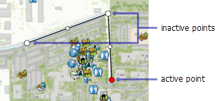
As you draw, the next point is placed into the shape following the active point. The point you add is joined to the shape with a line from the previously active point.
Using the map adds a point after the active point, connecting the two with a line segment. In a basic measurement scenario, the active point is the last point added, and the new point is added at the end of the shape. The new point becomes the active point and is connected to the previously active point by a new line segment.
To update a shape, select an existing point to make it the active point.
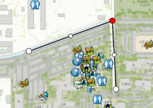
When a point is active, you can move it. Long press to show the magnifier, and use the magnifier to place the active point in its new location.
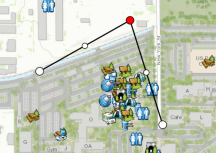
Use the map to add a point after the active point. When the active point is not the final point in the shape, lines are added to the shape that connect the newly added point to the active point you selected, and to the point that followed the selected active point. The newly added point becomes your active point.
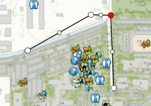
You can also select the midpoint of a line to insert a point along that line.
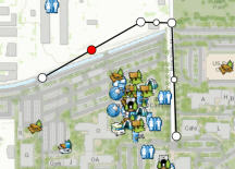
In the previous image, the line is selected, and its midpoint is the active point; however, a point is not inserted. The point is inserted when you use the map to provide a location for the new point.
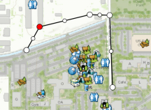
Select Use my location  to use your location and insert a point following the active point.
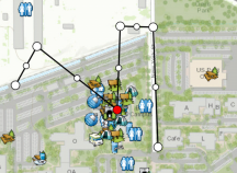
You can undo changes to the points, and you can delete the shape to start drawing from an empty shape. Expand the Overflow menu by selecting the Overflow icon  to view the additional actions available. Select Undo
  to cancel the last change (adding or moving of a vertex). Select Delete to clear the shape.
When editing a feature, you can also delete the currently active vertex, and you can use streaming to create the feature. Delete the currently active vertex by selecting Delete Vertex  . This action might be in the Overflow menu. Select Stream to create the feature using the GPS while you move.