You can add web feature layers to your drawing from web sources such as ArcGIS Online, ArcGIS Enterprise as well as a stand-alone ArcGIS Server using the Add Data and Add Data by URL options.
To limit the number of features that will be added to the drawing, set the project area from the main ribbon. If you do not set the project area, or if the area you set will result in the addition of more than 15,000 features, you are warned that the feature count exceeds the recommended maximum and you are presented with the option to cancel or continue adding the features for that layer. Another way to further limit the number of features is to specify a query expression to limit features by values, or ranges of feature attribute values. Web features can be published with query expressions that will be honored by ArcGIS for AutoCAD. You can override an existing query expression published on a web feature layer item by specifying your own.
Add Data
To add a web feature layer using the Add Data ribbon menu option, complete the following steps:
- On the ribbon, click the Add Data menu option.
- Sign in to the organization that contains the layer you want to add.
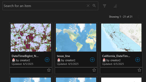
- Find the layer in the Add Data pane, click the thumbnail image to preview the layer, and click the + sign icon on the thumbnail tile to add the layer.

The web feature layer is added to your drawing.
Add Data by URL
To add a web feature layer using the Add Data by URL option, complete the following steps:
- On the ribbon, click the Add Data drop-down button.
- From the split menu, click the Add Data by URL menu option.
- In the Add Data by URL user interface, provide a URL that points to the layer, enter an optional branch version name and/or query expression, and click the Add button.

The web feature layer is added to your drawing.
Add Web Feature Layer by URL
To add individual sublayers of a web feature layer using the Add Web Feature Layer by URL option, complete the following steps:
- On the ribbon, click the Add Data drop-down button.
- From the split menu, click the Add Web Feature Layer by URL menu option.
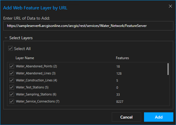
- In the Web Feature Layer by URL user interface, enter a URL that points to the main feature layer and then select the desired sublayers by checking and unchecking the sublayers from the provided layer name list, and push the Add button.

The web feature layers are added to your drawing.
Note:
Alternately you can enter the URL to a map image layer and any feature layers that support the Query and Data operations will be available for you to select and add to your drawing as read only feature layers.