Some of the new features of ArcGIS Drone2Map 2025.2 are described below.
Gaussian Splat layers
A new Gaussian Splats product has been added to ArcGIS Drone2Map. Gaussian Splats are an ellipsoidal representation of 3D points in space. In ArcGIS Drone2Map, they are generated as a 3D tile layer using deep learning and provide highly realistic visualizations of complex geometry that cannot be achieved with traditional photogrammetric approaches, capturing the fine details of infrastructure, vegetation, and urban environments with exceptional clarity.

Automatic detection and linking of control point markers
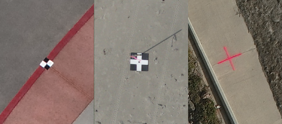
ArcGIS Drone2Map now uses deep learning libraries to automatically detect supported control point markers within input imagery and link them across multiple source images. The pretrained model can detect several types of control point markers as illustrated below and automatically link them for inclusion in the adjustment. This automation removes the need for manual linking, which is especially valuable when working with large datasets or running projects overnight. By streamlining this step, you can achieve high-accuracy outputs with less effort.
To learn more about the types of supported control markers, see Auto link control.

Improved True Ortho and DSM quality
The latest enhancements to True Ortho and DSM generation in ArcGIS Drone2Map offers a more consistent appearance across the products by using a smoother and more gap-filling interpolation during DSM creation. This benefits datasets that previously showed interpolation artifacts and small holes such as areas of heavy vegetation or low image coverage, ensuring that critical areas are visually complete.

Virtual Raster Tiles
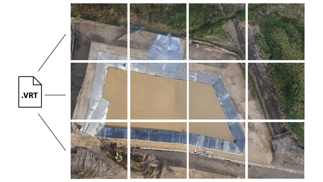
To improve usability and performance for large projects, ArcGIS Drone2Map now offers the option to retain Virtual Raster Tile (VRT) files (.vrt)and the individual tiles produced during processing. A .VRT file uses XML to contain all the parameters of the raster dataset. It allows viewing a seamless virtual mosaic of multiple raster’s without generating large output files. The VRT format is compatible with ArcGIS and many third-party platforms, enabling broader integration and faster workflows. Creating large TIFF files can now be skipped and instead VRTs can be used to visualize and share mosaics.

Share web scenes
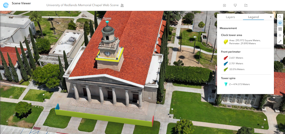
ArcGIS Drone2Map now enables the publishing of complete 3D web scenes, including point clouds and meshes, directly to ArcGIS Online and ArcGIS Enterprise in a single step. This eliminates the need to manually compile layers after upload and mirrors the simplicity of 2D web map sharing. The streamlined publishing process saves time and effort, making it easier to share rich content.

Drone image accuracy support
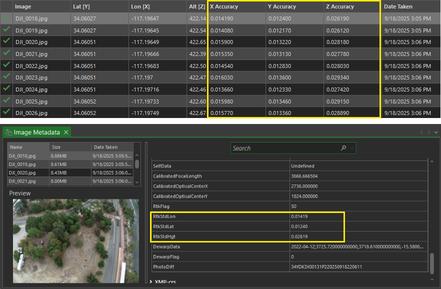
ArcGIS Drone2Map now automatically detects high-accuracy GPS metadata (RTK) embedded in drone imagery and activates the appropriate processing configuration. By reading horizontal and vertical accuracy values from image metadata (EXIF/XMP), optimal accuracy settings are applied without manual intervention. Image accuracy support also provides visibility into images with missing or low-quality accuracy data, helping maintain consistency across datasets.

3D correction features for mesh editing
Correction feature tools now offer a new in-app editing method for 3D meshes and point clouds allowing you to improve the output quality of those products directly in ArcGIS Drone2Map. These tools can help quickly fix issues in meshes, such as gaps on reflective surfaces, or building facades that are not fully complete due to limitations in image overlap or view angle. 3D correction features offer a new capability, providing clean, complete rendering in a 3D scene to share with stakeholders or the public.

Tile-based reprocessing
ArcGIS Drone2Map now supports intelligent tile-based reprocessing, allowing updates to specific areas of products such as true orthos, DSMs, and point clouds without reprocessing the entire project. When waterbody masks or correction features are applied, ArcGIS Drone2Map identifies only the affected tiles and reprocesses them selectively. This saves significant time and disk space, especially for large projects. This enhancement is ideal for workflows that require quick iteration and precise corrections.