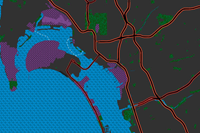
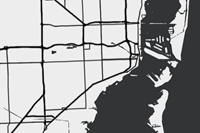
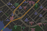
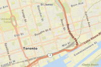
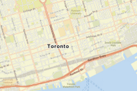
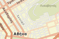
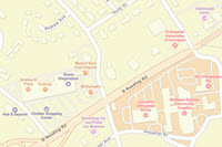
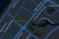
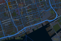
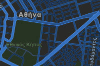
ArcGIS Data Appliance 2026: Esri Vector Basemaps includes the following 60 vector tile layers for the World Edition. The World Edition styles provide a non-specific international view of the world. These maps can be customized for country-specific basemaps for the user's preferred treatment of boundaries and place-names. The styles can be published in Web Mercator Auxiliary Sphere (WMA) projection or WGS84/GCS (GCS) tiling scheme.
The U.S. Edition has the same coverage as the World Edition with U.S. labels. The U.S. Edition styles include updated place-names defined by the U.S. government, as well as treatments of several disputed boundaries and places defined by the U.S. State Department; it includes 34 U.S. Edition map styles for the WMA format and 33 U.S. Edition map styles for the GCS format.
You do not need to install all of the map styles in the World Edition or the U.S. Edition. You can select the map styles you want to use when you publish new tile layers (map styles).
There are six new optional vector contour and hillshade multisource map styles that are available for use with the World and U.S. Editions in WMA format.
World Edition and U.S. Edition map styles
The following tables outline the World Edition and U.S. Edition map styles and the styles that are available in WMA and GCS format. The full collection is broken alphabetically into smaller tables:
- A-G map styles
- H-K map styles
- L-V map styles
- World N-World R map styles
- World S map styles
- World T-Z map styles
Note:
Map styles marked "Needed for U.S. Edition web map" in the U.S. Edition columns are the same as the World Edition. They are included so the U.S. Edition includes a full set of tile layer styles for the web map.
A-G map styles
| Layer name, [style folder name], and thumbnail | Description | World Edition (WMA) | World Edition (GCS) | U.S. Edition (WMA) | U.S. Edition (GCS) |
|---|---|---|---|---|---|
| Charted Territory [chartedterritory]
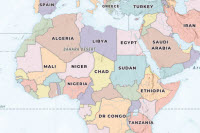
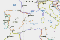
| The Charted Territory vector tile layer provides a detailed basemap featuring a geopolitical style reminiscent of a printed atlas plate or a school classroom wall map. This layer is designed for use with the World Hillshade basemap. |
|
|
|
|
| Colored Pencil [coloredpencil]
| The Colored Pencil vector tile layer is presented in the style of hand-drawn, colored pencil cartography. |
|
|
|
|
Community [community]
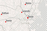
| The Community vector tile layer provides a detailed basemap featuring strong colors to emphasize large-scale features. |
|
|
|
|
| Dark Gray Canvas [canvasdark]
| The Dark Gray Canvas vector tile layer provides a detailed basemap of the world featuring a dark neutral background style with minimal colors, labels, and features. |
|
| — | — |
Dark Gray Canvas (Community Maps) [canvasdarkcommunity]
| The Dark Gray Canvas (Community Maps) vector tile layer provides a detailed basemap featuring a dark neutral background style with minimal colors, labels, and features with select roads provided by community contributors. |
|
| — | — |
| Dark Gray Canvas Base [canvasdarkbase]
| The Dark Gray Canvas Base vector tile layer provides a detailed basemap of the world featuring a dark neutral background style with minimal colors, labels, and features. This layer is designed for use with the Dark Gray Canvas Reference layer. |
|
|
|
|
Dark Gray Canvas Reference [canvasdarkreference]
| The Dark Gray Canvas Reference vector tile layer provides a city reference overlay of the world designed for use over a dark neutral background style with minimal colors, labels, and features. This layer is designed for use with the Dark Gray Canvas Base layer. |
|
|
|
|
Dark Gray Canvas Reference (Local Language) [canvasdarkreferencelocallanguage]
| The Dark Gray Canvas Reference (Local Language) vector tile layer provides a detailed reference label layer. Labels are in local languages at large scale. This layer is designed for use with the Dark Gray Canvas Base layer. |
|
| — | — |
Enhanced Contrast Base [enhancedcontrastbase]
| The Enhanced Contrast Base vector tile layer aims to meet the standards for Web Content Accessibility Guidelines (WCAG) and U.S. Government Section 508 compliance. It includes land cover, water bodies, and transportation linework. It is designed for use with the Enhanced Contrast Reference layer. |
|
|
Needed for U.S. Edition web map |
Needed for U.S. Edition web map |
Enhanced Contrast Dark Base [enhancedcontrastdarkbase]
| The Enhanced Contrast Dark Base vector tile layer aims to meet the standards for WCAG and U.S. Government Section 508 compliance. It includes land cover, water bodies, and transportation linework. It is designed for use with the Enhanced Contrast Dark Reference layer. |
|
|
Needed for U.S. Edition web map |
Needed for U.S. Edition web map |
Enhanced Contrast Dark Reference [enhancedcontrastdarkreference]
| The Enhanced Contrast Dark Reference vector tile layer aims to meet the standards for WCAG and U.S. Government Section 508 compliance. It includes administrative boundaries and map labels. It is designed for use with the Enhanced Contrast Dark Base layer. |
|
|
|
|
Enhanced Contrast Reference [enhancedcontrastreference]
| The Enhanced Contrast Reference vector tile layer aims to meet the standards for WCAG and U.S. Government Section 508 compliance. It includes administrative boundaries and map labels. It is designed for use with the Enhanced Contrast Base layer. |
|
|
|
|
H-K map styles
| Layer name, [style folder name], and thumbnail | Description | World Edition (WMA) | World Edition (GCS) | U.S. Edition (WMA) | U.S. Edition (GCS) |
|---|---|---|---|---|---|
Human Geography Base [humangeographybase]
| The Human Geography Base vector tile layer provides a detailed vector basemap of the world, symbolizing the land with a light gray, neutral background style. |
|
|
Needed for U.S. Edition web map |
Needed for U.S. Edition web map |
Human Geography Dark Base [humangeographydarkbase]
| The Human Geography Dark Base vector tile layer provides a simple vector basemap of the world, symbolizing the land with a very dark gray, neutral background style. |
|
|
Needed for U.S. Edition web map |
Needed for U.S. Edition web map |
Human Geography Dark Detail [humangeographydarkdetail]
| The Human Geography Dark Detail vector tile layer provides a detailed basemap with a dark monochromatic style and content adjusted to support human geography information. This layer is a detailed reference layer that includes administrative boundaries, roads, and highways. |
|
|
|
|
Human Geography Dark Label [humangeographydarklabel]
| The Human Geography Dark Label vector tile layer provides a detailed basemap with a dark monochromatic style and content adjusted to support human geography information. The map includes labels for highways, major roads, minor roads, water features, cities, landmarks, and administrative boundaries. |
|
|
|
|
Human Geography Detail [humangeographydetail]
| The Human Geography Detail vector tile layer provides a detailed basemap with a monochromatic style and content adjusted to support human geography information. |
|
|
|
|
Human Geography Label [humangeographylabel]
| The Human Geography Label vector tile layer provides a detailed vector basemap for world labels designed to draw attention to the thematic content. |
|
|
|
|
Hybrid Reference Layer [hybrid]
| The Hybrid Reference Layer vector tile layer provides a detailed reference layer of the world designed to be overlaid on imagery. |
|
|
|
|
Hybrid Reference Layer (Community Maps) [hybridreferencecommunity]
| The Hybrid Reference Layer (Community Maps) vector tile layer provides a detailed reference layer of the world designed to be overlaid on imagery with select roads provided by community contributors. |
|
| — | — |
Hybrid Reference Layer (Local Language) [hybridreferencelocallanguage]
| The Hybrid Reference Layer (Local Language) vector tile layer provides a detailed reference layer, including transportation and labels of the world. Labels are in local languages at large scale. This layer is designed for use with the World Imagery basemap. |
|
| — | — |
Hybrid Reference Layer (Places) [hybrid-places]
| The Hybrid Reference Layer (Places) provides a detailed reference layer of the world designed to be overlaid on imagery and includes places, or points of interest. These shops, services, restaurants, attractions, and other points of interest are displayed with icons and labels. |
|
| — | — |
L-V map styles
| Layer name, [style folder name], and thumbnail | Description | World Edition (WMA) | World Edition (GCS) | U.S. Edition (WMA) | U.S. Edition (GCS) |
|---|---|---|---|---|---|
Light Gray Canvas [canvaslight]
| The Light Gray Canvas vector tile layer provides a detailed vector basemap of the world symbolized with a light gray, neutral background style with minimal colors, labels, and features that is designed to draw attention to the thematic content. |
|
| — | — |
Light Gray Canvas (Community Maps) [canvaslightcommunity]
| The Light Gray Canvas (Community Maps) vector tile layer provides a detailed basemap featuring a light neutral background style with minimal colors, labels, and features. Select roads are provided by community contributors. |
|
| — | — |
Light Gray Canvas Base [canvaslightbase]
| The Light Gray Canvas Base vector tile layer provides a detailed basemap of the world featuring a light neutral background style with minimal colors, labels, and features. This layer is designed for use with the Light Gray Canvas Reference layer. |
|
|
|
|
Light Gray Canvas Reference [canvaslightreference]
| The Light Gray Canvas Reference vector tile layer provides a detailed reference overlay of the world featuring a light neutral background style with minimal colors, labels, and features. This layer is designed for use with the Light Gray Canvas Base layer. |
|
|
|
|
Light Gray Canvas Reference (Local Language) [canvaslightreferencelocallanguage]
| The Light Gray Canvas Reference (Local Language) vector tile layer provides a detailed reference label layer. Labels are in local languages at large scale. This layer is designed for use with the Light Gray Canvas Base layer. |
|
| — | — |
Mid-Century [midcentury]
| The Mid-Century vector tile layer provides a customized vector layer of the world symbolized with a unique mid-century-styled map. It takes its inspiration from the art and advertising of the 1950s with unique fonts. The symbols for cities and capitals have an atomic slant to them. |
|
|
|
|
Modern Antique [modernantique]
| The Modern Antique vector tile layer provides a customized vector layer of the world symbolized with a unique antique-styled map and a modern flair—including the benefit of multiscale mapping. |
|
|
|
|
National Geographic Style [natgeostyle]
| The National Geographic Style vector tile layer provides a detailed basemap featuring boundary ribbons and other map content. This layer is designed for use with the World Hillshade relief basemap for added context. |
|
|
| — |
National Geographic Style (Local Language) [natgeostylelocallanguage] 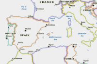 | The National Geographic Style (Local Language) vector tile layer provides a detailed basemap featuring boundary ribbons and other map content. This layer is designed for use with the World Hillshade relief basemap for added context. Labels are in local languages at large scale. |
|
| — | — |
Newspaper [newspaper]
| The Newspaper vector tile layer provides a customized vector layer of the world symbolized with a unique newspaper-styled map. It has a black and white appearance with select features highlighted in red. Many of the area fills have halftone patterns commonly found in traditional newspaper printing. |
|
|
|
|
Nova [nova]
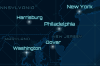
| The Nova vector tile layer provides a detailed basemap of the world featuring a dark background with glowing blue symbology inspired by the ArcGIS.com splash screen. The Nova vector tile layer emulates this color scheme with a grid pattern across the ocean and stripes or square stippled patterns for land-use features visible at larger scales. |
|
|
|
|
Outline [outline]
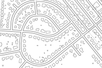
| The Outline vector tile layer provides a detailed basemap of the world featuring a simple black and white outline. |
|
| — | — |
World N-World R map styles
| Layer name, [style folder name], and thumbnail | Description | World Edition (WMA) | World Edition (GCS) | U.S. Edition (WMA) | U.S. Edition (GCS) |
|---|---|---|---|---|---|
World Navigation Map [navigation]
| The World Navigation Map vector tile layer provides a detailed basemap of the world featuring a custom navigation map style. |
|
|
|
|
World Navigation Map (Community Maps) [navigationcommunity]
| The World Navigation Map (Community Maps) vector tile layer provides a detailed basemap of the world featuring a custom navigation map style with select roads provided by community contributors. |
|
| — | — |
World Navigation Map (Local Language) [navigationlocallanguage]
| The World Navigation Map (Local Language) vector tile layer provides a detailed basemap of the world featuring a custom navigation map style. Labels are in local languages at large scale. |
|
| — | — |
World Navigation Map (Places) [navigation-places]
| The World Navigation Map (Places) vector tile layer provides a detailed basemap featuring a navigation map style with the additional content of global places. These shops, services, restaurants, attractions, and other points of interest are displayed with icons and labels. |
|
|
|
|
World Navigation Map (Dark Mode) [navigationdark]
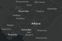
| The World Navigation Map (Dark Mode) vector tile layer provides a detailed basemap featuring a dark navigation map style. |
|
|
|
|
World Navigation Map (Dark Mode - Community Maps) [navigationdarkcommunity]
| The World Navigation Map (Dark Mode - Community Maps) vector tile layer provides a detailed basemap featuring a dark navigation map style with select roads provided by community contributors. |
|
| — | — |
World Navigation Map (Dark Mode - Local Language) [navigationdarklocallanguage]
| The World Navigation Map (Dark Mode - Local Language) vector tile layer provides a detailed basemap featuring a dark navigation map style. Labels are in local languages at large scale. |
|
| — | — |
World Navigation Dark Map (Places) [navigationdark-places]
| The World Navigation Dark Map (Places) vector tile layer provides a detailed basemap featuring a dark navigation map style with the additional content of global places. These shops, services, restaurants, attractions, and other points of interest are displayed with icons and labels. |
|
|
|
|
World Ocean Reference [oceanreference]
| The World Ocean Reference vector tile layer provides a detailed basemap featuring a custom ocean style. This layer is designed for use with the World Ocean Base raster layer. |
|
|
|
|
World S map styles
| Layer name, [style folder name], and thumbnail | Description | World Edition (WMA) | World Edition (GCS) | U.S. Edition (WMA) | U.S. Edition (GCS) |
|---|---|---|---|---|---|
World Street Map [streetmap]
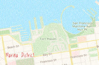
| The World Street Map vector tile layer provides a detailed basemap of the world featuring a classic Esri street map style. |
|
|
|
|
World Street Map (Community Maps) [streetmapcommunity]
| The World Street Map (Community Maps) vector tile layer provides a detailed basemap of the world featuring a classic Esri street map style with select roads provided by community contributors. |
|
| — | — |
World Street Map (Local Language) [streetmaplocallanguage]
| The World Street Map (Local Language) vector tile layer provides a detailed basemap of the world featuring a classic Esri street map style. Labels are in local languages at large scale. |
|
| — | — |
World Street Map (Places) [streets-places]
| The World Street Map (Places) vector tile layer provides a detailed basemap featuring a street map style with the additional content of global places. These shops, services, restaurants, attractions, and other points of interest are displayed with icons and labels. |
|
| — | — |
World Street Map (Night) [streetmapnight]
| The World Street Map (Night) vector tile layer provides a detailed basemap of the world featuring a custom nighttime street map style. |
|
|
|
|
World Street Map (Night - Community Map) [streetmapnightcommunity]
| The World Street Map (Night - Community Map) vector tile layer provides a detailed basemap of the world featuring a custom nighttime street map style with select roads provided by community contributors. |
|
| — | — |
World Street Map (Night-Local Language) [streetmapnightlocallanguage]
| The World Street Map (Night-Local Language) vector tile layer provides a detailed basemap of the world featuring a custom nighttime street map style. Labels are in local languages at large scale. |
|
| — | — |
World Street Map Night (Places) [streetsnight-places]
| The World Street Map Night (Places) vector tile layer provides a detailed basemap featuring a dark street map style with the additional content of global places. These shops, services, restaurants, attractions, and other points of interest are displayed with icons and labels. |
|
| — | — |
World Street Map (with Relief) [streetmaprelief]
| The World Street Map (with Relief) vector tile layer provides a detailed basemap of the world featuring a classic Esri street map style designed for use with a relief map. |
|
| — | — |
World Street Map (with Relief - Community Maps) [streetmapreliefcommunity]
| The World Street Map (with Relief - Community Maps) vector tile layer provides a detailed basemap of the world featuring a classic Esri street map style designed for use with a relief map. Select roads are provided by community contributors. |
|
| — | — |
World T-Z map styles
| Layer name, [style folder name], and thumbnail | Description | World Edition (WMA) | World Edition (GCS) | U.S. Edition (WMA) | U.S. Edition (GCS) |
|---|---|---|---|---|---|
World Terrain Base [terrainlabelsbase]
| The World Terrain Base vector tile layer displays minimal map content: water and land fill, water lines, and roads. This layer is designed for use as a base layer with the World Terrain Reference layer and World Hillshade basemap. |
|
|
Needed for U.S. Edition web map |
Needed for U.S. Edition web map |
World Terrain Reference [terrainlabelsreference]
| The World Terrain Reference vector tile layer displays minimal map content: populated place-names, administrative areas, and water labels with boundary lines. This layer is designed for use as a reference overlay with the World Terrain Base layer and the World Hillshade basemap. |
|
|
|
|
World Terrain Reference (Local Language) [terrainlabelsreferencelocallanguage]
| The World Terrain Reference (Local Language) vector tile layer provides a detailed reference layer of the world. Labels are in local languages at large scale. This layer is designed for use with the World Terrain Base layer and the World Hillshade basemap. |
|
| — | — |
World Terrain with Labels [terrainlabels]
| The World Terrain with Labels vector tile layer provides a detailed basemap of the world symbolized with populated places, administrative areas, boundary lines, and roads. The minimal features and styling are designed to draw attention to the thematic content. |
|
| — | — |
World Terrain with Labels (Community Maps) [terrainlabelscommunity]
| The World Terrain with Labels (Community Maps) vector tile layer provides a detailed basemap of the world symbolized with populated places, administrative areas, boundary lines, and roads. The minimal features and styling are designed to draw attention to the thematic content. Select roads are provided by community contributors. |
|
| — | — |
World Topographic Map [worldtopomap]
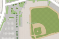
| The World Topographic Map vector tile layer provides a detailed basemap of the world featuring a classic Esri topographic map style designed for use with a relief map. |
|
|
|
|
World Topographic Map (Local Language) [worldtopomaplocallanguage]
| The World Topographic Map (Local Language) vector tile layer provides a detailed basemap of the world featuring a classic Esri topographic map style. Labels are in local languages at large scale. This layer is designed for use with the World Hillshade basemap. |
|
| — | — |
Vector contour and hillshade multisource map styles
The following table outlines the optional vector contour and hillshade multisource map styles that are available for use with the World Edition and U.S. Edition in WMA format. These vector tile layers provide unique capabilities for customization and high-resolution display. You must publish both the vector contour and vector hillshade vector tile packages to use these multisource map styles:
Note:
Map styles marked "Needed for U.S. Edition web map" in the U.S. Edition columns are the same as the World Edition. They are included so the U.S. Edition includes a full set of tile layer styles for the web map.
| Layer name, [style folder name], and thumbnail | Description | World Edition (WMA) | U.S. Edition (WMA) |
|---|---|---|---|
Environment Base [environmentbase]
| The Environment Base vector tile layer is designed for use as a base layer to support environment-related content. It de-emphasizes human elements and focuses more prominently on landscape features. Features include vegetation, parks, farming areas, open space, indigenous lands, military bases, bathymetry, large-scale contours, and elevation values. This is a multisource style. |
|
Needed for U.S. Edition web map |
Environment Detail and Label [environmentdetaillabel]
| The Environment Detail and Label vector tile layer supports environment-related content. It de-emphasizes human elements and focuses more prominently on landscape features. It features administrative boundaries and labels for populated places, oceans, topographic features, roads, rail, parks, schools, and hospitals. This layer is designed for use with the Environment Base, Environment Surface Water and Label, and Environment Watersheds layers to combine into one unified basemap. |
|
|
Environment Surface Water and Label [environmentsurfacewaterlabel]
| The Environment Surface Water and Label vector tile layer provides a global reference of surface water features and their respective labels. It features rivers, lakes, streams, and canals. This layer is designed for use with the Environment Base, Environment Detail and Label, and Environment Watersheds layers to combine into one unified basemap. |
|
Needed for U.S. Edition web map |
Environment Watersheds [environmentwatersheds]
| The Environment Watersheds vector tile layer was designed to show global watershed boundary lines. Map features in the layer are from the HydroSHEDS v1 dataset. This layer is designed for use with the Environment Base, Environment Detail and Label, and Environment Surface Water and Label layers to combine into one unified basemap. |
|
Needed for U.S. Edition web map |
Outdoor [outdoormap]
| The Outdoor vector tile layer provides a detailed basemap with an emphasis on the natural world. It includes rich cartographic styling with vector contours and vector hillshade. At small to mid scales, the land cover is presented by biome features. This layer includes highways, major roads, minor roads, railways, water features, cities, parks, landmarks, building footprints, and administrative boundaries. This is a multisource style. |
|
|
World Topographic Map (with Contours and Hillshade) [topowithcountours]
| The World Topographic Map (with Contours and Hillshade) vector tile layer provides a detailed vector basemap for the world symbolized with the classic Esri topographic map style including vector contours and vector hillshade for added context. This map includes highways, major roads, minor roads, railways, water features, cities, parks, landmarks, building footprints, administrative boundaries, and shaded relief for added context. This is a multisource style. |
|
|
