ArcGIS Earth 2.7.1 (June 2026)
ArcGIS Earth 2.7.1 includes bug fixes and performance enhancements incorporating ArcGIS Maps SDK for .NET 200.8.1.
ArcGIS Earth 2.7 (May 2026)
With the latest ArcGIS Maps SDK for .NET 200.8.1 release, new features and enhancements in ArcGIS Earth 2.7 are described below.
Customized imagery source in Historical Imagery Explorer
ArcGIS Earth adds support for custom imagery sources in Historical Imagery Explorer. After you configure time properties for the layer in ArcGIS Pro and publish it to ArcGIS Online or ArcGIS Enterprise, you can add and manage custom imagery sources in Historical Imagery Explorer. ArcGIS Earth can display multiple imagery sources at the same time, with each source shown in a different color on the timeline to help distinguish datasets and compare updates across sources.
Mobile scene package bookmark authoring
ArcGIS Earth introduces the ability to author, edit, and save bookmarks embedded in a mobile scene package (MSPK) directly from ArcGIS Earth on Desktop. Users can enter edit mode through the Bookmark panel, add or modify bookmarks that capture layer visibility states on a per-scene basis, and persist changes using Save or Save As. The updated MSPK can then be transferred to ArcGIS Earth Mobile, enabling a seamless desktop-to-mobile bookmark authoring workflow.
ArcGIS Earth supports editing and saving bookmarks in an MSPK on Desktop. You can edit bookmarks for each scene in an MSPK and save the changes to the original MSPK or a new .mspk file. The updated bookmarks can be viewed in ArcGIS Earth on mobile devices.
Other key enhancements
Other enhancements at this release include the following:
- Multiple-feature pop-up support—An optional scroll view for pop-ups was added that contains multiple features, allowing you to browse and select individual features.
- Historical imagery performance—Performance when loading and exploring imagery services in Historical Imagery Explorer has been improved.
- KML placemark icon transparency—Support for setting placemark icon transparency, including custom images, using the <color>attribute in KML was added.
ArcGIS Earth 2.6 (January 2026)
With the latest ArcGIS Maps SDK for .NET 200.8.1 release, new features and enhancements in ArcGIS Earth 2.6 are described below.
Historical imagery
ArcGIS Earth 2.6 introduces access to Historical Imagery under the 3D Effects menu. This new capability provides an interactive experience for exploring historical versions of the World Imagery basemap. Users can browse and compare imagery versions directly on the globe using a timeline slider, with dynamic highlights indicating available local updates.
Other key enhancements
Other enhancements at this release include the following:
- KML custom namespace support—Support was added for loading and parsing custom name spaces declared in KML file headers, enabling access to custom attributes and extended metadata.
- Altitude mode in KML tracks—Enhanced support was added for Altitude Mode within KML track and multitrack elements, allowing more accurate interpretation and visualization of elevation data along path lines.
- Mobile mosaic dataset rendering—Rendering performance was improved for mobile mosaic dataset layers stored in mobile geodatabases, providing smoother visualization and better responsiveness.
- Memory management improvements—Memory usage when loading large datasets has been optimized, resulting in improved stability and overall performance during heavy 3D visualization workflows.
ArcGIS Earth 2.5.1 (October 2025)
ArcGIS Earth 2.5.1 includes bug fixes and performance enhancements incorporating ArcGIS Maps SDK for .NET 200.8. It resolves an issue that could cause the application to crash when running a geosearch operation.
ArcGIS Earth 2.5 (August 2025)
With the latest ArcGIS Maps SDK for .NET 200.8, new features and enhancements in ArcGIS Earth 2.5 are described below.
Split and combine MultiGeometry features in KML
ArcGIS Earth 2.5 supports selecting and combining multiple KML features—including points, polygons, polylines, tracks, and models—into a single MultiGeometry KML. It also allows splitting a MultiGeometry KML into individual KML feature.
Other key enhancements
Other enhancements at this release include the following:
- Support for streaming control of stream layer inside a web map, with the same experience of individual stream layer in ArcGIS Earth.
- Support for recording raw NMEA files in the current workspace during GNSS track recording.
- Improved user interaction with GNSS features. A more visible 3D bubble highlights the live location of your device, even when viewing a large area on the map.
- Support for batch anchor point setting of KML points.
- Ability to move (drag-and-drop) more than one KML at once.
- Support to disable and hide the Updater-related setting in ArcGIS Earth.
- Optimized refresh logic of the legend panel to prevent unnecessary reloads during camera zoom and other movements.
- For Grids, the Label Position option is now conditionally displayed based on the selected Grid Type to streamline the configuration experience.
- The ArcGIS Earth app link has been enhanced with new and updated parameters to share the current view including viewpoint, data from portal items or online services, and the basemap. See the details in App integration.
- A new configuration option <featureServiceTilingMode> has been added to config.xml, allowing administrators to control feature service tiling globally; when set to On (default), ArcGIS Earth uses feature tiling whenever it is supported by the service, and when set to Off, feature tiling is disabled globally, which may improve performance in some cases but can leave features undisplayed if the view exceeds the service's MaxRecordCount.
ArcGIS Earth 2.4 (April 2025)
With the latest ArcGIS Maps SDK for .NET 200.7, new features and enhancements in ArcGIS Earth 2.4 are described below.
Real-time stream service support
ArcGIS Earth now supports real-time stream services, allowing you to visualize and interact with dynamic, live streaming data.
- Supports adding and filtering Stream Service type from ArcGIS Online, or the authenticated stream services after you're signed in.
- Allows you to interactively snapshot or drag a spatial filter to include streaming data within the area of interest.
- Allows you to set purge options to optimize the local cache of ArcGIS Earth, ensuring a smoother and faster experience.
- Supports streaming control to connect and disconnect from stream source, clear observations, view stream layer performance statistic information, and specify observation display options.
- Supports layer visibility, symbology, elevation mode, labels, and more layer properties. You can optionally show the previous observations and tracks of moving features, such as vehicles, and differentiate the current (latest) observations from previous ones with distinct symbology.
- Allows you to interact with the dynamic entities by identifying and following them in the scene, with pop-up information that can be switched between dynamic entities and static observations.
OpenStreetMap 3D basemap support
ArcGIS Earth now supports OpenStreetMap 3D basemap, offering enhanced visualization of 3D building layers.
- In the basemap gallery, available from the connected portal, 3D basemaps are identified by a 3D badge in the top right corner of each thumbnail.
- Selecting the building layer loads the highest-resolution 3D building data to date.
3D grid support
ArcGIS Earth supports display and customization of grid within scenes, helping you visualize spatial reference systems or partition map frames.
Choose from four supported grid types through scene properties:
- Longlat—Geographic coordinate system grid
- UTM—Universal Transverse Mercator zones
- MGRS—Military Grid Reference System
- USNG—United States National Grid
Customize grid appearance using enhanced styling options:
- Modify line properties (color, width, transparency) for grid components
- Adjust label styling (font, size, halo) in the label pane
- Position labels dynamically relative to grid lines or map edges
KML track/multitrack support
ArcGIS Earth now enables KML track property editing, extended data charting, and enhanced time animation experiences.
- Support various styles of both placemark and lines of KML track
- Enable Extended data charting supports in Elevation Profile panel
- Smoother experience and better accessibility of time animation
- Support realtime GNSS layer and historical GPS file (.nmea, .gpx) to be exported as KML tracks
Other key enhancements
Other enhancements at this release include the following:
- Offline support for Survey123—Support for loading and editing Survey123 in an offline environment, where you can configure the Survey123 service address with config.json.
- Compact tile cache for terrain—Support for compact tile caches with web elevation layer tiles in the Terrain panel.
- Basemap layer visibility—Granular control for 2D and 3D basemaps with multiple sublayers. Turn on and off individual sublayer visibility and dynamically combine them to create custom layer combinations.
- New draped options for elevation mode—Support for new options in the Draped elevation mode for point feature layers and scene layers. You can choose Draped Billboard (icons face the camera) or Drape Flat (icons lay flat on the ground).
- Hardware acceleration for remote desktop—Hardware acceleration is now supported in remote desktop environments. This enables GPU-powered rendering, which improves performance and delivers smoother, more responsive graphics in remote desktop sessions.
- KML enhancements:
- Interactive KML model editing—Support for interactively editing KML models with an enhanced Properties window.
- Improved style support in Table of Contents—Support for complex styles including <linkName>, <linkSnippet>, and <linkDescription> in the Table of Contents.
- Support to customize the minimum allowable value of elevation exaggeration in the configuration file.
- Enhancements on styling and interactivity of pop-up windows for better user experience.
ArcGIS Earth 2.3 (December 2024)
With the latest ArcGIS Maps SDK for .NET 200.6, new features and enhancements in ArcGIS Earth 2.3 are described below.
Real-time GNSS
ArcGIS Earth now supports real-time GNSS integration, enabling live GNSS feeds for accurate location tracking. Connect your GNSS device to ArcGIS Earth to view current locations, capture observation points, and record tracks over time for playback and path analysis. You can also import historical NMEA files to review past movements. For details, see Real-time GPS.
Survey123 integration
ArcGIS Earth now integrates with Survey123 for seamless management and interaction with survey records directly in the app, supporting data collection, editing, and visualization through Survey123 forms.
- A new portal item, Survey123 Form, is available in the Add Data window with search and filter options to locate and add surveys to your scene.
- Create or edit records using Survey123 forms.
- Add and edit feature geometry linked to records directly on the globe.
- Link existing features from the table of contents to automatically populate survey responses.
- Monitor survey results within ArcGIS Earth.
Read compact cache files
ArcGIS Earth now reads compact cache files from a specified folder path. Add a tile cache folder from Add from Path in the Add Data panel, selecting the Tile Package/Caches type. Ensure the folder includes a tiling scheme file (conf.xml or root.json).
Reverse geocoding with What's Here
Use the What's Here tool on the right-click context menu to identify addresses or locations on the globe. The result displays a place name and detailed address, which you can use for tasks like saving or getting directions.
Download tiles
ArcGIS Earth now supports bringing online layers for offline use, such as field work or disconnected environments. Tile layers and vector tile layers are supported.
Only layers configured for offline use are downloadable. Set the target layer, download extent, map export scale, and export path to create a tile or vector tile package.
Space mouse navigation
Navigate ArcGIS Earth with 3D input devices like the 3DConnexion SpaceMouse Enterprise. Enable this in navigation settings to fly, rotate, and explore the scene with ease.
Spatial filter
Now you can apply spatial filters to 3D object and point scene layers. There are two approaches supported:
- By polygon—Draw multiple polygons to include or exclude features.
- By selection—Select individual features to exclude them.
Both methods can be combined for precise selection. Filter results are saved to the workspace for reuse.
Interactive analysis instruction and animation control
The From Camera and From Point modes have been combined, adding text and image guidance for each state in Line of Sight and Viewshed analysis. In Animation mode, model speed is now accurate in meters per second, with a progress bar and frame-by-frame controls for precise playback.
Earth movie integrated media marker and animation
For images, GIFs, and video markers, you can add a title, description, and media. The format settings of text content—including font family, font size, alignment, and padding—are collapsed by default. The title and description can be independently enabled or disabled.
The Fly in and Fly out animation action was redesigned. Choose your preferred mode and decorate your movie with these upgraded effects.
Other key enhancements
Other enhancements at this release include the following:
- KML track support—You can load and play time animation of KML track and multi-track.
- Feature layer pop-ups—You can disable and enable feature layer pop-ups. The default pop-up behavior of the layer added to ArcGIS Earth respects the setting predefined in the service.
- Terrain Exaggeration Notification—A warning appears when Terrain Exaggeration is set to zero. Adjust it with the notification link.
- Basemap web map support—Web Map is an option for ArcGIS Earth's basemap.
- KML radius—You can display and save the KML radius.
- Rendering mode—You can switch between static and dynamic rendering modes for a better feature rendering experience.
- Timezone toggle—You can switch between local and UTC time zones for time-enabled data playback.
- WFS filtering—You can filter WFS types from ArcGIS Online or ArcGIS Enterprise in the Add Data window.
- Heading angle toggle button—You can switch between 360 degree and ±180 degree heading angles.
- Reverse KML line direction—You can reverse the direction of lines during KML geometry editing.
- KML enhancements:
- Address tag—ArcGIS Earth now recognizes <address> tags in KML files, geocoding and zooming to the location upon addition.
- Aspect ratio lock—You can lock the aspect ratio for KML ground and screen overlays during editing.
- Unit support—You can read and edit X and Y units (Pixel or Fraction) for KML Screen Overlay.
- Time-enabled overlays—You can display time-enabled KML screen overlays with the time slider.
- Anchor point positioning—You can specify the KML point symbol Anchor Point in the Icon panel of point Properties, reflected in <Hotspot> attributes. By default, the anchor point is at the center of the point symbol.
- Automatically resize the KML pop-up—Automatically fit the KML pop-up window size to the content size in ArcGIS Earth Settings.
- View bound scale editing—Support to read and edit View Bound Scale of KML Network link on the Refresh tab in Properties, which scales the BBOX parameters before sending them to the server. By default, it is 1.
ArcGIS Earth 2.2.1 (July 2024)
ArcGIS Earth 2.2.1 includes bug fixes and performance enhancements incorporating ArcGIS Maps SDK for .NET 200.4.
ArcGIS Earth 2.2 (May 2024)
With the latest ArcGIS Maps SDK for .NET 200.4, new features and enhancements in ArcGIS Earth 2.2 are described below.
OGC 3D Tiles layer
This release of ArcGIS Earth adds support for a new layer type, 3D Tiles. 3D Tiles is an Open Geospatial Consortium (OGC) standard that is designed for streaming and rendering large volumes of 3D geospatial content, similar to Indexed 3D Scene Layer (I3s). ArcGIS Earth supports Batched 3D Model (.b3dm) and 3D Tiles Archive Format (.3tz) 3D Tiles formats for visualizing continuous meshes or discrete 3D objects.
- Add a tileset from a local directory in a supported file format (.json or .3tz) or from online sources such as 3D tile services hosted in ArcGIS Online or a third-party web server. Services hosted outside of ArcGIS must not require authentication or use token-based authentication.
- 3D tile layers can be used with interactive analysis tools such as line of sight and viewshed.
WGS 1984 basemaps
When users change the ArcGIS Earth spatial reference from Web Mercator to WGS84, the application will automatically source the associated WGS84 basemaps from ArcGIS Online within the basemap gallery. This change improves overall performance for those who use WGS84 as their default spatial reference.
Star background
NASA's realistic stars background replaces the generic space background.

Bookmarks
The following bookmark enhancements have been made:
- You can now export bookmarks as video. Videos created from bookmarks will be rendered at 1080p, 30fps. You can choose between the efficiency or balanced modes for processing.
- Bookmarks can now be imported into a movie project where they can be further edited and customized.
ArcGIS Earth movie enhancements
The following movie enhancements have been made:
- New toolbar options have been added to improve the overall user experience when working with blocks and tracks.
- New and unique narrative possibilities come with three added marker types: GIF, Video, and Billboard.
- In-app voice-over is now supported. Click the record button in the audio track to begin narrating your video in real time.
- Three export modes have been added to give you more control over processing time and output quality: Efficiency, Balanced, and Quality.
App link
ArcGIS Earth now supports universal app link with parameters. See Integrate with other apps for supported parameters.
Base URL: https://earth.arcgis.app/.
Other key enhancements
The following enhancements have been made:
- PKI authentication has been enhanced to improve client authentication from content originating from a third-party PKI server.
- Support for <NetworkLinkControl><message> syntax has been added. This enhancement enables the delivery of pop-up messages, such as data licensing and use guidelines, when a KML network link is loaded.
- Enhanced time animation of KML:Track, providing better play back performance and experience of playing tracks by time intervals.
- Placemarks can now be created by right-clicking the globe.
- Improved handling of referenced files (icons, image overlays, attachments, and so on) when saving as .kml and .kmz.
- Support for KML ground and screen overlays has been enhanced. You can expect improved support for large image sources, improved performance in localized environments, and clear indicators for unsupported image formats.
- Portal manager includes enhancements to the user experience, including improvements to editing and refreshing connections.
- Enhanced text selection in layer name and title input boxes. Double-click to select part of the text and triple-click for the entire string.
- Enhanced symbology reset of a feature layer. Now, resetting a feature layer's symbology to default also considers symbol styles predefined in web maps, web scenes, or group layers, not just the original feature layer style.
- The camera Update button and Zoom To button action are updated in Movie. The buttons are unavailable if you click to avoid duplicated or incorrect actions.
- User interface enhancements:
- Improved drag-and-drop experience in the table of contents, especially with layers that use a multiple-line snippet.
- Support keyboard shortcuts for a stacked pop-up window navigation.
- Support zooming to the custom startup view snapshot in Settings.
- Enhancements to feature layer editing, respecting the default field value predefined in the service, and a clear appearance of the Null field in a layer's attribute table.
ArcGIS Earth 2.1 (December 2023)
With the latest ArcGIS Maps SDK for .NET 200.2, new features and enhancements in ArcGIS Earth 2.1 are described below.
ArcGIS Earth updater
When a new software version is available, you will receive a notification when opening the application. The notification will assist you in downloading and installing the update, keeping you up to date on the latest features, enhancements, and security updates.
Workspace management updates
ArcGIS Earth uses workspaces to manage and store a working history of your data and settings. Workspaces allow you to organize and manage projects, maintain a consistent work environment, collaborate, and share your work. They are managed in settings, under the General tab. A few minor changes have been made to workspace management in this release:
- Open—Open an existing workspace directory folder.
- Save as—Save your current workspace to a new destination.
- Import—Import a workspace folder.
- Export—Export a workspace folder.
- Clear—Remove all content in the current workspace.
Label KML lines and polygons
Support for KML labels has been significantly improved. In addition to placemarks, labeling is supported for lines and polygons. You will no longer have to create a separate placemark layer or multigeometry for labeling line and polygon geometries. Placemark, line, and polygon labels are handled the same and will become visible when enabled in the Properties window.
KML enhancements
The following KML enhancements have been made:
- Layer highlight—A highlight effect has been applied to selected layers in My Drawings and KMLs. This highlight effect will help identify which layer is selected in your scene when a line or polygon uses the cyan color.
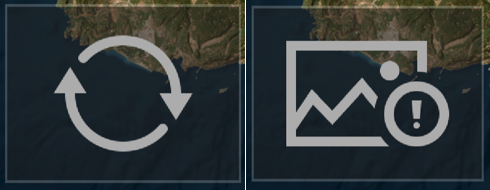
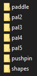
- Visual status indicator for screen and ground overlays—Visual indicators have been added to the user interface to help identify the status of ground and screen overlays. These indicators are in the properties window and on the overlay itself. If an overlay fails to load, the overlay will display an image indicating there was a problem.
- KML icon enhancements—ArcGIS Earth supports KML icons in both a
connected and disconnected environment. See
Administrator configuration
to learn more about enabling KML icons for
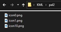
offline use. By default, ArcGIS Earth has icon groups paddle,
pushpin, and shapes preinstalled. Beginning with this release,
additional KML icon groups are supported. See the directions below
to add more KML icons. In addition to supporting more KML icons, transparency is now respected for all placemark icons.
- Download desired KML icons as needed.
- Create a folder in the following directory with a KML icon group name: \ArcGIS Earth\bin\ArcGISRuntime200.x\resources\symbols\kml. The image below provides an example *\kml directory with icon groups pal2, pal3, pal4, and pal5 added.
- Move KML icon .png files to their appropriate group folder.
- Respect the level of detail—KML level of detail is now respected. When working with very large datasets, KML regions can be used for increased performance. Level of detail is a subcomponent of KML regions and allows you to define what data is rendered based on the number of pixels present on the screen. When level of detail syntax is applied, you can expect a more dynamic visualization experience and an increase in performance. For more details on KML regions and level of detail, refer to the OGC KML 2.3 specification.
- Pop-ups—Additional support of '<BalloonStyle>' has been added to pop-up behavior controlled by KML syntax. For example, you can configure KML layers to block pop-up balloons by specifying <displayMode> in KML data. In addition, a bug that was causing edits to KML description and HTML to be erased or modified has been fixed.
- Custom background colors—Background colors can be applied to KML items in the table of contents. Background color is set using the following syntax:
<ListStyle>
<bgColor>colorcode</bgColor>
</ListStyle>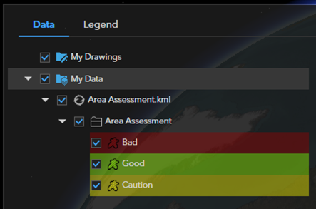
- Physical units—Support for gx:physicalWidth has been added, which allows you to assign a physical width of a line in meters. This enhancement provides additional customization options for visualization. The physical line width displayed in the view is calculated according to the scale and should be interpreted as an approximate value. The width measured in the view may differ from the defined physical width.
- Complex snippet styles—Snippets are used for displaying short descriptions of KML layers in the table of contents. Various enhancements have been made to respect more complex snippet styles, providing you more control over how KML layers are displayed in the table of contents.
Navigation enhancements
The following navigation enhancements have been made:
- Disable default fly to angle—An option has been added to settings to disable the default fly to angle. When the setting is set to none, flying to layers will maintain an overhead perspective.
- On-screen navigator options—Three
on-screen navigator
options have been added to settings. These
options are as follows:
- Default—The on-screen navigator is collapsed by default unless you hover over it. When hovered over, it will become expanded.
- Collapsed—The on-screen navigator remains collapsed.
- Expanded—The on-screen navigator remains expanded.
Added support for location unit input
Support for Degree Decimal Minutes coordinates has been added. In addition, support for negative latitude and longitude coordinates has been added.
Reorder and rename GeoPackage and mobile geodatabase sublayers
Enhancements have been made to GeoPackage and mobile geodatabase support. ArcGIS Earth supports the renaming and reordering of layers residing inside a mobile geodatabase or GeoPackage. In addition, changes are recorded within the active workspace and will be remembered between sessions.
Scene layer elevation offset
You can adjust the elevation offset of 3D point scene layers when in Absolute mode. In addition, a bug was fixed which resulted in 3D object scene layers being locked in drape mode. 3D object scene layers render in Absolute mode by default and allow you to apply an elevation offset if needed.
Time-enabled data
Improvements have been made to the handling of time-enabled data in ArcGIS Earth. The first improvement was made to the time slider. The time slider dynamically adjusts its range based on which KML layers are activated. Prior to this release, the time slider range was locked to the full range of the source KML. In addition, playback animation of time-enabled data has also improved. KML nodes are only visible when they fall within the desired playback range.
Layout
Improvements were made to the export layout feature. When adding marginalia elements, you can use undo/redo and copy/paste hot keys. In addition, the user experience has been improved when adding text boxes and a legend element.
Export elevation profiles as CSV
You can export elevation profiles as .csv files. Export options include the default interval or custom nodes drawn on the globe for detailed line analysis.
ArcGIS Earth 2.0 (July 2023)
New features and enhancements in ArcGIS Earth 2.0 are described below.
Highlights
The following are new or improved in ArcGIS Earth 2.0:
- ArcGIS Earth Movie includes improved video creation and exporting, providing 3D customizable options.
- Enable the ability to edit feature services directly in ArcGIS Earth.
- Customize ArcGIS Earth to suit your needs by personalizing tool preferences and settings.
Features
The following features have been added or improved:
- ArcGIS Earth Movie—The ArcGIS Earth Movie interface and features allow you to create and export customizable videos as part of your geospatial storytelling.
- Feature service editing—Support to edit feature services directly in ArcGIS Earth has been added, with the capability to customize attributes and geometry to suit your needs.
- Enhanced user interface—The overall user interface has been optimized with a cleaner look.
- Quick dock customization—Support to personalize your tool preference by customizing the quick dock area has been added. Click Settings > Customization.
- User notification—Stay informed with user notifications that provide updates with messages, important information, system alerts, and activity updates.
- Startup tips—Follow the new startup tips to get started with a tutorial after starting ArcGIS Earth for the first time.
Enhancements
The following enhancements have been added:
- Keyboard shortcuts—Find relevant keyboard shortcuts with the new query window added to the About page.
- CSV-related workflow—The workflow to add .csv files has been enhanced to provide a more user-friendly experience.
- Pop-up improvements—Support for ArcGIS Arcade expressions, more HTML styles, more media content, and hyperlinks to external web browsers have been added.
- KML node batch editing—Multiple KML nodes can be selected and edited at the same time. Symbology configurations are applied to the viewport for an improved editing experience.