This deep learning model can be used to classify addresses into their respective countries.
Accurate locations of people or places of interest are important to drive business and improve government services. For accurate location, correctly geocoding addresses is necessary. Street addresses may sometimes be missing the country information, and geocoding incomplete addresses often results in poor accuracy. Geocoding accuracy and performance increases when the country is specified. This model categorizes incomplete addresses by automatically assigning the country they belong to.
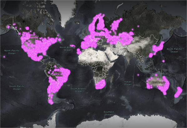
This deep learning model is trained on an address dataset provided by openaddresses.io and can be used to classify addresses from 18 countries.
License requirements
To complete this workflow, the following are the license requirements:
- ArcGIS Pro—Advanced license
- ArcGIS API for Python
Model details
This model has the following characteristics:
- Input—Text on which country classification will be performed. Text should include street number or apartment number, street name, city, or state.
- Output—Text (country).
- Compute—This workflow is compute intensive, and a GPU with compute capability of 6.0 or higher is recommended.
- Supported countries code/name—This model works with addresses from 18 countries:
- AR—Argentina
- AT—Austria
- AU—Australia
- BE—Belgium
- CA—Canada
- CH—Switzerland
- DE—Germany
- DK—Denmark
- ES—Spain
- FI—Finland
- FR—France
- IS—Iceland
- IT—Italy
- KR—South Korea
- LU—Luxembourg
- NZ—New Zealand
- SI—Slovenia
- US—United States
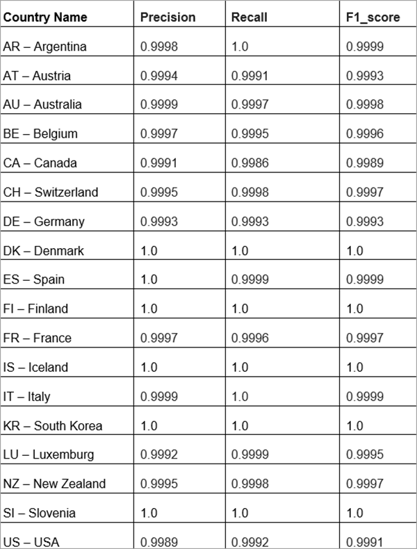
- Accuracy metrics— The table below summarizes the precision, recall and F1-score of the model on the validation dataset.

Access and download the model
Download the Country Classification pretrained model from ArcGIS Living Atlas of the World.
- Browse to ArcGIS Living Atlas of the World.
- Sign in with your ArcGIS Online credentials.
- Search for Country Classification and open the item page from the search results.
- Click the Download button to download the model.
You can use the downloaded .dlpk file directly in ArcGIS Pro, or upload and use it in ArcGIS Enterprise. Additionally, you can fine-tune the pretrained model if necessary.
Release notes
The following are the release notes:
| Date | Description |
|---|---|
| July 2022 |
|