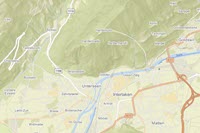
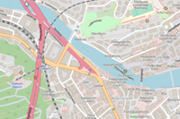
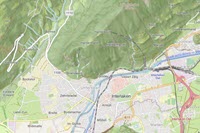
Open Vector Basemaps includes the following 13 vector tile layers. The styles can be published in the Web Mercator Auxiliary Sphere (WMA) projection or the WGS84/GCS (GCS) tiling scheme.
Note:
Open Vector Basemaps: Basic (WMA only) displays map features down to ~1:144,000.
| Layer name and thumbnail | Style folder name | Description |
|---|---|---|
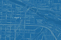
| Open Basemap Blueprint
| obblueprint | This vector tile layer is based on the Overture Maps data, which features OpenStreetMap and other open data sources. It provides a global basemap symbolized in a cartographic style like a blueprint technical drawing. |
| Open Basemap Dark Gray Canvas Base
| obdarkgraycanvasbase | This vector tile layer is based on the Overture Maps data, which features OpenStreetMap and other open data sources. It provides a global base layer featuring a dark gray, neutral style designed to draw attention to your thematic content. This layer is designed to be used with the Open Basemap Dark Gray Canvas Reference layer. |
Open Basemap Dark Gray Canvas Reference
| obdarkgraycanvasreference | This vector tile layer is based on the Overture Maps data, which features OpenStreetMap and other open data sources. It provides a global reference layer featuring labels. This layer is designed to be used with the Open Basemap Dark Gray Canvas Base layer. |
Open Basemap Hybrid Reference
| obhybridreference | This vector tile layer is based on the Overture Maps data, which features OpenStreetMap and other open data sources. It provides a global reference overlay featuring highways, major and minor roads, railways, water features, cities, parks, landmarks, administrative boundaries, and map labels. |
| Open Basemap Light Gray Canvas Base
| oblightgraycanvasbase | This vector tile layer is based on the Overture Maps data, which features OpenStreetMap and other open data sources. It provides a global base layer featuring a light gray, neutral style designed to draw attention to your thematic content. This layer is designed to be used with the Open Basemap Light Gray Canvas Reference layer. |
Open Basemap Light Gray Canvas Reference
| oblightgraycanvasreference | This vector tile layer is based on the Overture Maps data, which features OpenStreetMap and other open data sources. It provides a global reference layer featuring labels. This layer is designed to be used with the Open Basemap Light Gray Canvas Base layer. |
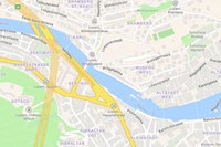
Open Basemap Navigation
| obnavigation | This vector tile layer is based on the Overture Maps data, which features OpenStreetMap and other open data sources. It provides a global basemap symbolized in a navigation map style, emphasizing the road network and urban landscape for daytime use. |
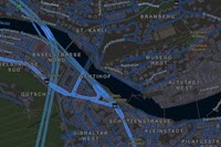
Open Basemap Navigation Dark
| obnavigationdark | This vector tile layer is based on the Overture Maps data, which features OpenStreetMap and other open data sources. It provides a global basemap symbolized in a navigation map style, emphasizing the road network and urban landscape for night use or low-light environments. |
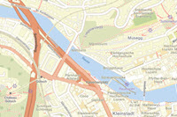
Open Basemap Streets
| obstreets | This vector tile layer is based on the Overture Maps data, which features OpenStreetMap and other open data sources. It provides a global basemap symbolized in a street map style, emphasizing the road network and urban landscape. |
Open Basemap Streets Night
| obstreetsnight | This vector tile layer is based on the Overture Maps data, which features OpenStreetMap and other open data sources. It provides a global basemap symbolized in a street map style, emphasizing the road network and urban landscape, designed for use at night or other low-light environments. |
Open Basemap Streets with Relief
| obstreetsrelief | This vector tile layer is based on the Overture Maps data, which features OpenStreetMap and other open data sources. It provides a global basemap symbolized in a street map style, emphasizing the road network and urban landscape and designed to be used with shaded relief. |
OpenStreetMap Style
| obopenstreetmap | This vector tile layer is based on the Overture Maps data, which features OpenStreetMap and other open data sources. It provides a global basemap with cartography representative of the OpenStreetMap style. |
OpenStreetMap Style with Relief
| obopenstreetmaprelief | This vector tile layer is based on the Overture Maps data, which features OpenStreetMap and other open data sources. It provides a global basemap with cartography representative of the OpenStreetMap style, designed to be used with shaded relief. |
