ArcGIS Data Appliance 2026 imagery and elevation data includes the following improvements and enhancements.
Note:
ArcGIS Data Appliance provides information about the ArcGIS Data Appliance product options, and ArcGIS Data Appliance 2026 content includes a table to help you understand the difference between the services in each product option.
World Imagery
The World Imagery basemap was updated with more recent, higher-accuracy, and more detailed imagery.
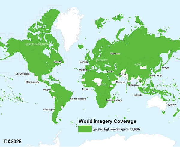
World Imagery basemap updates include high-resolution satellite and aerial imagery. Large portions of the world include updates from Maxar's constellation of high-resolution imaging satellites, while select areas include high-resolution aerial photography updates through Esri's Community Maps Program. Additional information is available in the World Imagery service description and in the associated metadata layer provided with your source documents.
The following map shows the updated coverage in this release:

License:
Coverage is defined by the product option you licensed.
World Hillshade and World Hillshade (Dark)
The World Hillshade and World Hillshade (Dark) layers were updated with lidar-derived 50-centimeter data for Wallonia (Belgium); 1-meter data for Austria, Slovakia, Vlaanderen (Belgium), Wales (UK), San Mateo County (CA, USA), German States of Bavaria, Saxony, Brandenburg, and Hessen, and parts of New Zealand, Canada, and the United States; 2-meter data for parts of Canada; and 10-meter data for Austria and the United States.
This release also includes updates from Maxar Precision3D at 50-centimeters covering approximately 6 million kilometers2 for parts of the globe.
World Elevation
The Terrain 3D layer was updated with lidar-derived 50-centimeter elevation data for Wallonia (Belgium); 1-meter elevation data for Austria, Slovakia, Vlaanderen (Belgium), Wales (UK), San Mateo County (CA, USA), German States of Bavaria, Saxony, Brandenburg, and Hessen, and parts of New Zealand, Canada, and the United States; 2-meter elevation data for parts of Canada; and 10-meter elevation data for Austria and the United States.
The Terrain layer was updated with lidar-derived 30-centimeter elevation data for the Nebraska (USA) counties of Sarpy, Douglas, and Lancaster; 50-centimeter elevation data for Cook County (Illinois, USA); 1-meter elevation data for England, France, Wales, Bavaria (Germany), Saxony (Germany), Brandenburg (Germany), parts of New Zealand, and the United States; and 10-meter elevation data for Italy and the United States.
Elevation Analysis
The Profile, Viewshed, and Summarize Elevation geoprocessing tools were updated with 10-meter elevation data for Austria and the United States along with 30-meter elevation data for Canada, Mexico, and the United States.