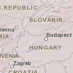
Map Service Name:World_Boundaries_and_Places_Alternate
Description: This map is in mature support; this is the last release of Data Appliance for ArcGIS that will include the World Boundaries and Places Alternate map. See ArcGIS Product Lifecycle Support Policy for more information on mature support.
This map presents country boundaries; first-order (state/province) internal administrative boundaries for most countries; second-order administrative boundaries for the United States (counties), Canada, India, New Zealand, and some countries in Europe; and place-names for the world. Alignment of boundaries is a presentation of the feature provided by Esri data vendors and does not imply endorsement by Esri or any governing authority.
The map was developed by Esri using administrative and cities data from Esri; Garmin basemap layers for the world; HERE data for North America, Europe, Australia, New Zealand, South America and Central America, Africa, India, and most of the Middle East; OpenStreetMap data for some features in select African countries and Pacific Islands; and feature names from the GIS user community. View the list of Contributors for the World Boundaries and Places Map (PDF). Data for select areas of Africa and Pacific Island nations was sourced from OpenStreetMap contributors. Specific country list and documentation of Esri's process for including OSM data is in OSM Data Usage in Esri's ArcGIS Online Basemaps (PDF).
This map is designed for use with maps with lighter backgrounds.
This map provides coverage for the world down to a scale of ~1:144k.
The reference layer includes similar coverage to World Boundaries and Places.
Attribution:Sources: Esri, Garmin, HERE, © OpenStreetMap contributors, and the GIS user community
Coordinate System: Web Mercator Auxiliary Sphere (WKID 102100)
Tiling Scheme: Web Mercator Auxiliary Sphere
Map Service Data Format: Map server cache in PNG32 format