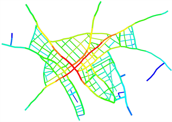
Graph networks can be analyzed by computing global integration, local integration, and in-between centrality. For each street, these values are computed and stored as object attribute integrationGlobal, integrationLocal, and inbetweenCentrality. The values can be visualized or used to approximate street widths.
To open the dialog box, select a set of graph segments or a graph layer and click Graph > Analyze Graph in the main menu.
Settings
The following table lists the setting for the Analyze Graph tool:
Mode | Three modes are available:
|
Depth of local integration | The number of 90-degree turns to take into account to compute the local integration value. |
Roadbed lanes min | Roadbed lane width lower bound; it is only used in Set street width mode. |
Roadbed lanes max | Roadbed lane width upper bound; it is only used in Set street width mode. |
Sidewalk width min | Sidewalk width lower bound. |
Sidewalk width max | Sidewalk width upper bound |
Definitions
All shortest paths between all selected street segments are computed. The shortest path cost function is the sum of all angles between the segments along the path.
Global integration
For each street segment, the shortest paths to all other segments are summed up. Each sum is then divided by the square of the number of segments. Next, each value is inverted. Finally, the values are normalized so that each value is in the range zero to one.
Local integration
For each street segment, the shortest paths to all other segments which are closer than (Depth of local integration) 90-degree turns are summed up. Each sum is then divided by the square of the number of visited segments. Next, each value is inverted. Finally, the values are normalized so that each value is in the range zero to one.
Inbetween centrality
For each street segment, the number of shortest paths that pass this segment is computed. Then, the values are normalized so that each value is in the range zero to one.
Example
