There are several ways to visualize the variables and data slices in a multidimensional mosaic dataset.
With the multidimensional mosaic dataset selected in the Contents pane, you can work with the tools available on the Multidimensional tab to display specific slices of data and variables.
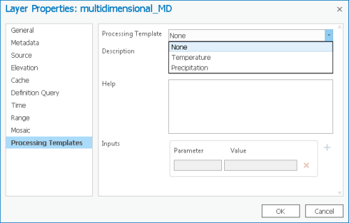
You can also use processing templates to visualize the variables or their derivatives. You can access the processing templates for the mosaic dataset on the Processing Templates tab in the mosaic dataset Properties window, or in the Processing Templates drop-down menu in the mosaic layer Data tab set.

You can add a single slice from the mosaic dataset as a layer in the map using the Multidimensional Filter raster function or using the Raster Item Explorer.
If a mosaic dataset is created with the vector field template, such as wind or current data, it can be visualized using the Vector Field renderer.
Default display properties can be set in the Mosaic Dataset Properties window.
For information on how to create a multidimensional mosaic dataset using netCDF, HDF, or GRIB files, see Create a multidimensional mosaic dataset. For information on how to create a multidimensional mosaic dataset using a stack of raster images over time, see Create a multidimensional mosaic dataset from a set of time series images.
The workflow below details the steps to visualize the data slices you want to see in a multidimensional mosaic dataset.
- Add the multidimensional mosaic dataset to a map in ArcGIS AllSource.
- In the Contents pane, select the mosaic dataset layer and click the Multidimensional tab in the Mosaic Layer tab set.
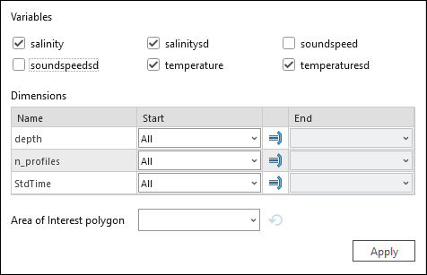
- In the Multidimensional Extent group, choose the variable to display. Then set the Start and End values for StdTime or, if your mosaic dataset has another dimension, set StdZ values to limit the depth or height values you want to visualize. Optionally, click the Area of Interest drop-down arrow
 to choose a feature layer to use to clip the display to a specific feature extent.
- If you selected multiple variables in the Multidimensional Extent group, choose the variable you want to display in the Current Display Slice. Select the specific time and height or depth, if applicable.

The resulting slice will be displayed in the map view.
- To automatically display the slices over time or another dimension, click the Play Slices Along button
 next to the StdTime or StdZ values. Click the Play Time Direction arrow
  to change the direction of Autoplay to backward or forward.