The Managing Elevation workflow provides a set of geoprocessing tools and best practices for managing multi-resolution elevation data using mosaic datasets, and creating additional datasets like slope or aspect that are based on that elevation data.
Check out the Try It Out tab to get a guided, hands-on walkthrough of the workflow tools, included setting them up and applying them to sample data.
Check out the Workflow tab for a deeper dive into the more technical best practices for managing elevation data using mosaic datasets.
Ready to get the workflow scripts and tools? Download them now.
What is elevation data?
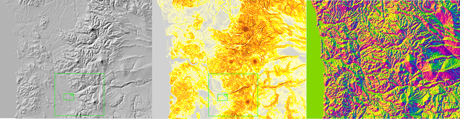
Elevation rasters (digital terrain models or digital elevation models, for example) store elevation measurements for a given area in an evenly spaced grid. These datasets can also be used to derive datasets like hillshades, slope, or aspect to use for visualization or analysis.
Who uses the workflow?
The Managing Elevation workflow is typically used by people managing collections of elevation data with experience using mosaic datasets. Often, people using this workflow need to provide end users with derived products for visualization (like hillshades) or analysis (like viewshed calculations), rather than raw elevation data.
Requirements
This workflow requires specific technical experience and software, and is designed to work with certain types of imagery.
| Requirement | Description |
|---|---|
Suggested Experience |
|
Software |
|
Input data |
|
Known limitations
There are no known limitations for this workflow.
What do you get?
To try automating the Managing Elevation workflow with Python scripts, you will download two zip files:
| Directory | Description |
|---|---|
| ElevationScript.zip | ZIP archive containing Python scripts, geoprocessing tools, and batch files for building mosaic datasets to manage elevation data, and to create ancillary datasets like slope or hillshade |
| ElevationSampleDataDownload.zip | ZIP archive containing multiple preprocessed elevation datasets of Portland, Oregon to use with the workflow scripts |
What's new
Below are release dates and notes for this workflow.
| Date | Description |
|---|---|
August 2017 | Workflow updated to work with ArcGIS Pro |
March 2017 | First release of the Managing Elevation workflow |