Assess the Accuracy of Orthomosaics and Digital Elevation Models
Find resources to perform an accuracy assessment of ortho imagery and/or digital elevation models (DSMs and DTMs).

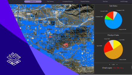
Coordinate a Drone Operation
Find resources describing how to create and deploy a turnkey UAS imagery operation system using Site Scan for ArcGIS, Experience Builder, and ArcGIS Workforce.

Work with Synthetic Aperture Radar Data
Find resources describing how to process and analyze SAR satellite imagery.

Capture Drone Imagery Using Site Scan Flight
Find resources for planning and executing flights to acquire drone imagery using Site Scan for ArcGIS.

Create Drone Imagery Products Using Site Scan Manager
Find resources explaining how to create 2D and 3D products using Site Scan for ArcGIS.

Host Imagery Using ArcGIS Image for ArcGIS Online
Find resources describing how to upload, host, and manage imagery in the cloud using ArcGIS Image for ArcGIS Online.

Analyze Imagery Using ArcGIS Image for ArcGIS Online
Find resources describing how to analyze imagery in the Map Viewer using ArcGIS Image for ArcGIS Online.

Perform Image Change Detection
Find resources describing how to perform pixel-to-pixel and time-series change detection in ArcGIS.

Manage Multidimensional Data
Find resources describing how to manage and share multidimensional raster datasets in ArcGIS.

Create Digital Aerial Imagery Products Using ArcGIS Pro
Find resources describing how to create 2D and 3D products from digital aerial imagery using reality mapping.

Create Satellite Imagery Products Using ArcGIS Pro
Find resources describing how to create orthomosaics, DEMs, and stereo models from satellite imagery using reality mapping.

Create Scanned Aerial Imagery Products Using ArcGIS Pro
Find resources describing how to create orthomosaics, DEMs, and stereo models from scanned aerial imagery using reality mapping.

Create Drone Imagery Products Using ArcGIS Pro
Find resources describing how to create 2D and 3D products from drone imagery using reality mapping.

Manage Medium-Resolution Satellite Imagery
Find resources describing how to manage and share medium-resolution satellite data, like Landsat and Sentinel-2, in ArcGIS.

Analyze Multidimensional Data
Find resources describing how to perform analysis on scientific data across multiple variables and dimensions.

Analyze Imagery Using Raster Functions
Find resources explaining how to use raster functions to perform dynamic, on-the-fly processing and analysis on imagery and rasters.

Perform Image Classification
Find resources describing how to classify imagery using machine learning to identify patterns and differences in land cover.

Visualize and Exploit Lidar and Elevation
Find resources describing how to visualize and share 3D point clouds and lidar-derived products.

Site Suitability Analysis
Find resources describing how to perform raster-based site suitability analysis to find locations that meet established criteria.

Manage and Visualize Oriented Imagery
Find resources showing how to manage and visualize non-nadir imagery, including street-side, panoramic, and inspection images.

Distributed Processing with Raster Analytics
Find resources describing how to use distributed image processing and storage to generate information products.

Manage Lidar Data
Find resources describing how to manage and share lidar point clouds and derived raster products.

Generate and Publish Tile Cache
Find resources describing how to serve imagery as cached image tiles hosted on ArcGIS Online or your ArcGIS Enterprise portal.

Use Deep Learning for Feature Extraction
Find resources describing how to use deep learning tools in ArcGIS to classify and extract features from imagery.

Visualize Full Motion Video
Find resources describing how to visualize geotagged video in ArcGIS Pro.

Exploit Imagery in Image Space
Find resources describing how to use image space in ArcGIS Pro to visualize oblique imagery, perform feature compilation, and make measurements.

Manage Frame Camera Imagery
Find resources for managing raw imagery from frame sensors and applying a photogrammetric model within ArcGIS.

Visualize Spectral Indices
Find resources describing how to apply spectral indices to your imagery for visualization and analysis across the ArcGIS platform.

Manage Drone Imagery
For users with large drone imagery collections, find resources for implementing scalable data management solutions for use with Drone2Map or ArcGIS Pro ortho mapping.

Use Mosaic Datasets to Manage Imagery
Find resources describing how to use mosaic datasets to manage all kinds of imagery and rasters.

Visualize Stereo Imagery
Find resources describing how to visualize stereo imagery, perform feature compilation, and make measurements using stereo imagery in ArcGIS Pro.

Create Drone Imagery Products Using ArcGIS Drone2Map
Find resources explaining how to create 2D products (orthomosaics, digital surface models) and 3D products (point clouds, textured meshes) using Drone2Map.

Manage High-Resolution Satellite Imagery
Find resources explaining how to create mosaic datasets to manage and visualize imagery from high resolution (< 5m) satellites.

Manage Scanned Maps
Find resources explaining how to create mosaic datasets to manage and display collections of scanned maps.

Manage Browse Imagery
Find resources explaining how to create mosaic datasets to manage and publish reference imagery (thumbnails) to use in applications to search full-resolution content.

Manage Elevation
Find resources explaining how to use mosaic datasets to manage elevation data and visualize aspect, hillshade, and slope.

Manage Preprocessed Orthophotos
Find resources explaining how to use mosaic datasets to manage your preprocessed orthophotos.
No results found.
Would you like to start over?
Reset