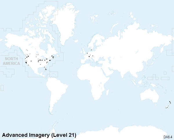
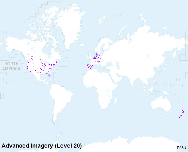
As illustrated in the coverage maps below, coverage in the World Imagery basemap from Data Appliance 6.4 for ArcGIS is provided at the following scales:
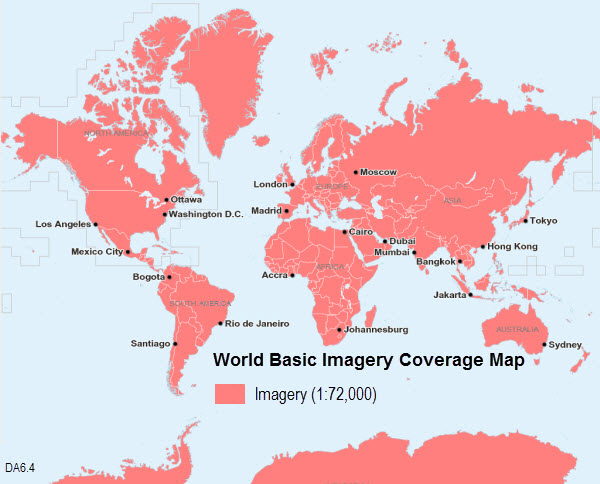
World Basic
- ~1:591M down to ~1:72k using 15-meter imagery.
- Coverage also includes 2.5-meter imagery, where available, at ~1:577k down to ~1:72k.
World Standard
- Everything in World Basic.
- At larger scales, includes 2.5-meter imagery, where available, down to ~1:9k worldwide.
- Geographic coverage and levels of detail for 1-meter and higher-resolution imagery at scales ~1:9k to ~1:1k is the same as Data Appliance 6.0. Imagery was updated at these scales wherever new imagery was available.
World Advanced
- Everything in World Basic.
- At larger scales, includes 2.5-meter imagery, where available, down to ~1:9k.
- At ~1:9k to ~1:282, all available imagery is included, both geographically and in levels of detail.
North America Standard
- Everything in World Basic.
- At larger scales, includes 2.5-meter imagery, where available, down to ~1:9k for North America.
- Geographic coverage and levels of detail for 1-meter and higher-resolution imagery at scales ~1:9k to ~1:1k is the same as Data Appliance 6.0 for North America. Imagery was updated at these scales wherever new imagery was available.
North America Advanced
- Everything in World Basic.
- At larger scales, includes 2.5-meter imagery, where available, down to ~1:9k for North America.
- At ~1:9k to ~1:282, all available imagery within North America is included, both geographically and in levels of detail.
World Basic Imagery coverage map
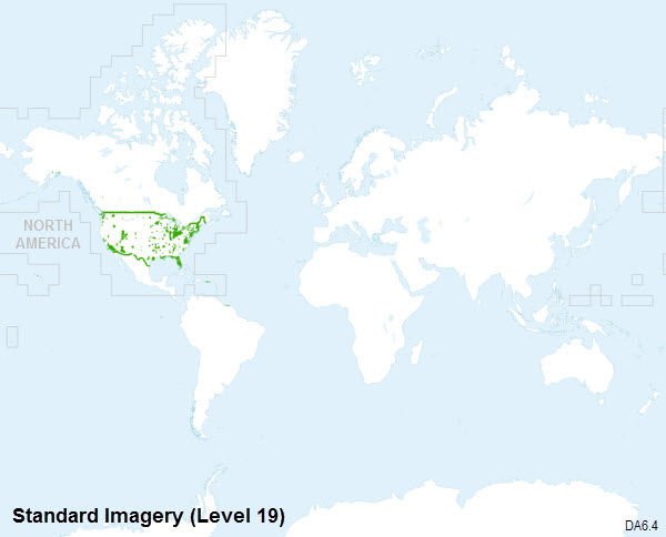
Standard Imagery coverage maps
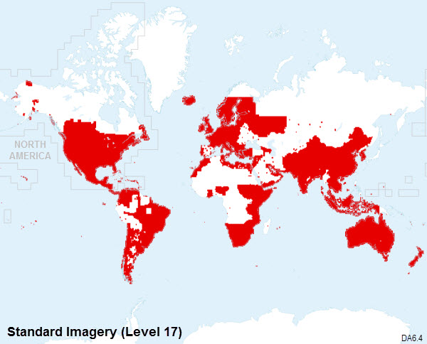
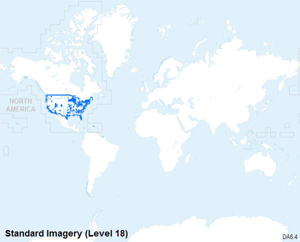
The following coverage maps are applicable to both World and North America Standard.
Standard Imagery coverage map at 1:4,000 (Level 17)
Standard Imagery coverage map at 1:2,000 (Level 18)
Standard Imagery coverage map at 1:1,000 (Level 19)
Advanced Imagery coverage maps
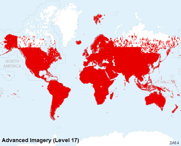
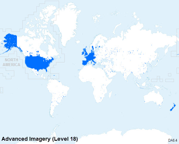
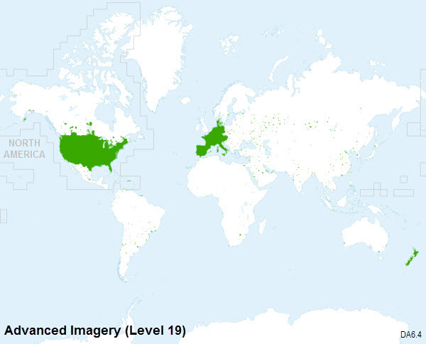
The following coverage maps are applicable to both World and North America Advanced.
Advanced Imagery coverage map at 1:4,000 (Level 17)
Advanced Imagery coverage map at 1:2,000 (Level 18)
Advanced Imagery coverage map at 1:1,000 (Level 19)
Advanced Imagery coverage map at 1:600 (Level 20)
Advanced Imagery coverage map at 1:282 (Level 21)
